Click to visit the main New York Public Library Homepage
The New York Public Library
Digital Collections
About Digital Collections
Browse
Search only public domain materials
Items
Collections
Divisions
Home
Search
Browse
About
Search only public domain materials
Items
Collections
Divisions
Digital Collections
Using Images
Using Data
Collections
Atlases of the United States
Atlases of the United States
Navigation
About
Filters
Atlases of the United States
Previous
United States
42
Indiana
1
Kentucky
2
Maryland
1
New Jersey
910
New York
2887
Wisconsin
23
Michigan
2
More
Collection Data
Description
The Map Division's collection of historical atlases of the United States, showing states, counties, and cities. Includes fire insurance, cadastral, geological, and pictorial maps, dating largely from the 19th and early 20th centuries.
Library locations
Lionel Pincus and Princess Firyal Map Division
Topics
United States
Genres
Atlases
Maps
Type of Resource
Cartographic
Identifiers
Universal Unique Identifier (UUID): 2600a3f0-c5ec-012f-424e-58d385a7bc34
Show filters
Hide filters
Show Only Public Domain
topic
Real property
32
name
x
Nichols, Beach
Stranahan, H. B
32
Pomeroy, Whitman & Co
24
collection
x
Atlases of the United States
place
x
New York (State)
Fulton County
32
Fulton County (N.Y.)
32
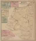
Montgomery County
32
Montgomery County (N.Y.)
32
More
Less
genre
Atlases
56
Maps
49
Title pages
2
Prints
1
publisher
Stranahan & Nichols
32
Pomeroy, Whitman & Co
24
division
Map Division
56
type
cartographic
49
text
8
still image
1
Date Range
to
56 results found
Filtering on:
x
Name
: Nichols, Beach
x
Place
: New York (State)
Sort by:
Title
Date created
Date digitized
Sequence
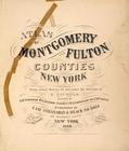
Atlas of Montgomery and Fulto…
Table of Contents
Table of Air-Line Distances
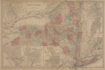
Oswego; Buffalo; Rochester; S…
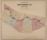
Outline Map of Montgomery Co.…
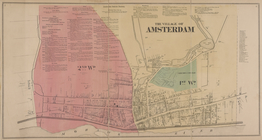
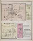
The Village of Amsterdam [Vil…
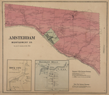
Amsterdam Montgomery Co. [Tow…
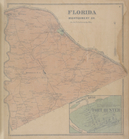
Florida Montgomery Co. [Towns…
Tribes Hill [Village]; Tribes…
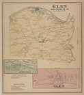
Glen Montgomery Co. [Township…
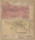
Fonda Business Directory; Fon…
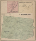
Burtonville [Village]; Charle…
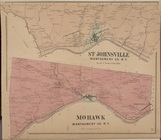
St. Johnsville Montgomery Co.…
Currytown [Village]; Sprakers…
Palatine Church [Village]; Pa…
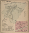
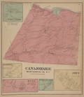
Canajoharie [Village]; Canajo…
Sprout Brook [Village]; Sprou…
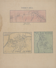
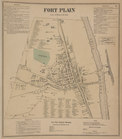
Fort Plain [Village]; Fort Pl…
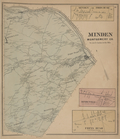
Mindenville [Village]; Minden…
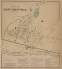
Plan of Saint Johnsville [Vil…
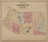
Outline Map of Fulton Co. New…
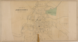
Johnstown Business Directory;…
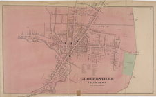
Gloversville Business Directo…
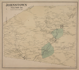
Johnstown Fulton Co. [Townshi…
Kingsboro [Village]; Mayfield…
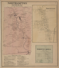
Northampton Fulton Co. [Towns…
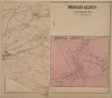
Broad Albin Fulton Co. [Towns…
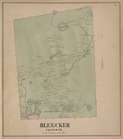
Bleecker Fulton Co. [Township]
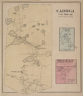
Caoga Fulton Co. [Township]; …
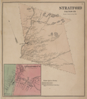
Stratford Fulton Co. [Townshi…
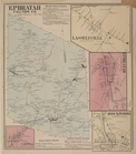
Ephratah Fulton Co. [Township…
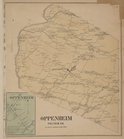
Oppenheim Fulton Co. [Townshi…
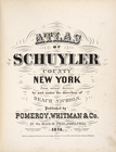
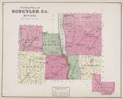
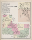
Atlas of Schuyler County, New…
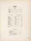
Index
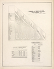
Table of Distances, Schuyler …
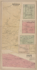
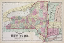
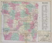
Map of the State of New York
Outline Plan of Schuyler Co. …
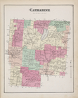
Catharine [Township]
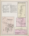
Catharine Business Notices; O…
Cayuta Business Notices; Cayu…
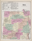
Town of Dix Business Notices;…
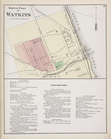
North Part of Watkins [Villag…
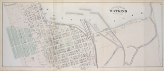
Center Part of Watkins [Villa…
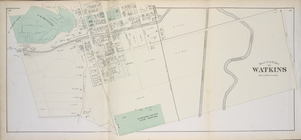
South Part of Watkins [Villag…
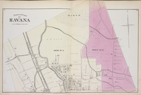
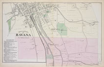
North Part of Havana [Village]
South Part of Havana [Village]
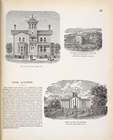
Res. of E. W. Cook, Havana, N…
Hector [Township]; Town of He…
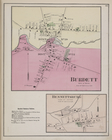
Burdett [Village]; Burdett Bu…
Mecklenburg [Village]; Perry …