Click to visit the main New York Public Library Homepage
The New York Public Library
Digital Collections
About Digital Collections
Browse
Search only public domain materials
Items
Collections
Divisions
Home
Search
Browse
About
Search only public domain materials
Items
Collections
Divisions
Digital Collections
Using Images
Using Data
Search
Filtered search
Show filters
Hide filters
Show Only Public Domain
topic
Real property
8328
Fire insurance
4696
Cities & towns
4483
Administrative and political divisions
895
Railroads
740
More
Less
name
Sanborn Map Company
4486
G.W. Bromley & Co
845
Austro-Hungarian Monarchy. Militärgeographisches Institut
773
Beers, F. W. (Frederick W.)
649
Bromley, George Washington
640
More
Less
collection
Atlases of New York City
7309
Atlases of the United States
3350
Maps of North America
3291
Maps of New York City and State
1840
Lawrence H. Slaughter Collection of English maps, charts, globes, books and atlases
1240
More
Less
place
New York (State)
9284
New York
2035
New York (N.Y.)
1383
Brooklyn (New York, N.Y.)
1026
Manhattan (New York, N.Y.)
865
More
Less
genre
Maps
18268
Atlases
3277
Topographic maps
1017
Cadastral maps
588
Nautical charts
392
More
Less
publisher
Sanborn Map Company
4618
K.u.K. Militargeographisches Institut
773
G.W. Bromley & Co
664
publisher not identified
447
E. Belcher Hyde
437
More
Less
division
x
Map Division
Wallach Division: Photography Collection
18
type
cartographic
18170
text
613
still image
289
Date Range
to
18,735 results found
Filtering on:
x
Date
: 1490 - 1913
x
Division
: Map Division
Sort by:
Title
Date created
Date digitized
Sequence
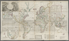
A new and correct map of the …
A new and correct map of the …
Lloyd's topographical map of …
m
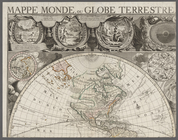
Mappe monde, ou globe terrest…
m
Our new colonies : Cuba, Port…
Insulae Moluccae celeberrimae…
m
Nuevo mapa topográfico de la …
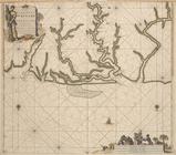
Pas kaart van de zee kusten v…
m
Map of the Cedar Knolls, at B…
Plan of the town of Paramarib…
A map of Dutch settlements of…
Pas-kaart vande Rivieren Comm…
Isothermal chart, or, View of…
Plan of the Central Park, Cit…
Saratoga Springs [Township]
Schuylerville Business Direct…
Saratoga [Township]
Stillwater [Township]
References; Waterford [Villag…
Waterford [Township]
Beechers Hollow [Village]; Be…
Wilton [Township]
Map of Saratoga County
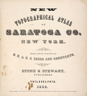
New topographical atlas of Sa…
Residence of James Carrigan, …
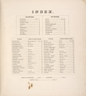
Index
Acres of Land, Population, Dw…
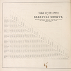
Table of Distances in Saratog…
Ballston [Township]
Ballston Spa Business Directo…
Charlton [Township]
Grangerville [Village]; Grang…
Clifton Park [Township]
Corinth [Township]; Palmer Fa…
Clifton Park [Village]; Clift…
Day Corners Business Director…
Edinburgh [Township]
Crescent [Village]; Crescent …
Galway [Township]; Yorks Corn…
Greenfield [Township]; Pages …
Bloodville [Village]; Bloodvi…
Hadley [Township]; Hadley Bus…
Half Moon [Township]
Factory Village [Village]; Fa…
Malta [Township]
Burnt Hills [Village]; Burnt …
Milton [Township]
Moreau [Township]
Conklingville [Village]; Conk…
Northumberland [Township]
1
2
3
4
5
6
7
8
9
10
…
74
75
Previous
Next
1
2
3
4
5
6
7
8
9
10
…
74
75
Previous
Next