Click to visit the main New York Public Library Homepage
The New York Public Library
Digital Collections
About Digital Collections
Browse
Search only public domain materials
Items
Collections
Divisions
Home
Search
Browse
About
Search only public domain materials
Items
Collections
Divisions
Digital Collections
Using Images
Using Data
Search
Filtered search
Show filters
Hide filters
Show Only Public Domain
topic
Houses
77
Historic buildings
63
Homes and haunts
20
Trees
15
churches
15
More
Less
name
DeBevoise, C. Manley
236
Van der Weyde, William M. (William Manley), 1870-1928
8
Bache, A. D. (Alexander Dallas), 1806-1867
7
United States Coast Survey
7
Hassler, F. R. (Ferdinand Rudolph), 1770-1843
6
More
Less
collection
Photographic views of the United States
304
Maps of New York City and State
18
Robert N. Dennis collection of stereoscopic views
15
Maps of North America
8
Collection of photographs of New York City, New York State and more by Max Hubacher
4
More
Less
place
x
Long Island (N.Y.)
New York (State)
347
United States
310
Long Island Sound (N.Y. and Conn.)
24
East Hampton (N.Y.)
19
More
Less
genre
Photographs
326
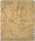
Maps
35
Stereographs
15
Prints
9
Nautical charts
6
More
Less
publisher
U.S. Coast Survey office
4
G.W. & C.B. Colton & Co
2
Published for the use of the Royal Navy of Great Britain by Joseph F. W. Des Barres
2
Thomas Jefferys
2
s.n
2
More
Less
division
Milstein Division
308
Map Division
31
Wallach Division: Photography Collection
18
Wallach Division: Print Collection
10
Spencer Collection
2
More
Less
type
still image
337
cartographic
35
text
1
Date Range
to
372 results found
Filtering on:
x
Date
: 1540 - 1870
x
Place
: Long Island (N.Y.)
Sort by:
Title
Date created
Date digitized
Sequence
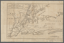
Map showing the New York and …
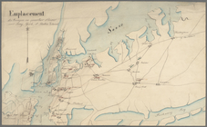
Emplacement des troupes en qu…
m
Eastern part of Long Island S…
Long Island Sound (western sh…
Middle part of Long Island So…
Tidal currents of Long Island…
Map of Long Island: showing t…
m
A map of the most inhabited p…
m
A map of the most inhabited p…
m
A map of the most inhabited p…
The state of Connecticut: inc…
Connecticut and parts adjacent
A new and accurate map of Con…
Western part of the southern …
Middle part of the southern c…
Eastern part of the southern …
m
Map of Long Island and adjace…
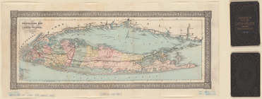
Travellers map of Long Island
m
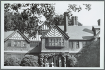
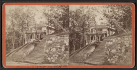
Old house in Garden City, Lon…
m
Old house in Garden City, Lon…
m
Old house in Garden City, Lon…
m
The Cutting Mansion near Baby…
Map of Massachusetts, Connect…
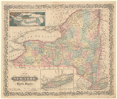
Map of the State of New York
Windmill, Long Island; Misty …
E. N. E. view of the west end…
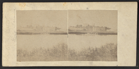
View of Long Island & East Ri…
m
Minutes of the Committee of B…
[A chart of New York Island &…
A chart of New York Island & …
m
Map of the progress of His Ma…
A plan of New York Island, pa…
A plan of New York Island, wi…
m
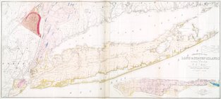
Geological map of Long & Stat…
Chart and plan of the harbour…
A plan of New York Island, wi…
An original sketch by an Engl…
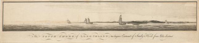
The south shore of Long Islan…
m
Newtown Creek, Long Island.
m
Denmans Cottage Sea-Cliff [Se…
m
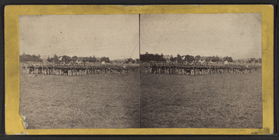
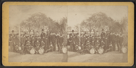
Field Day, East N. Y. 37th re…
m
In the surf at Long Island.
m
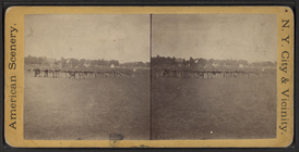
Field Day, East N. Y. 37th re…
m
Jamaica Pond.
m
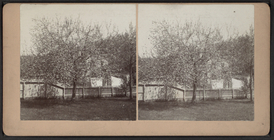
Trees in bloom.
m
View of trees.
m
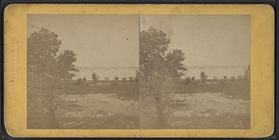
Long Island Sound.
m
College Point. L. I..
m
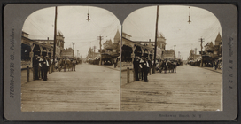
Rockaway Beach. N. Y..
m
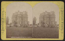
Bishop's residence. Garden Ci…
1
2
Previous
Next
1
2
Previous
Next