Click to visit the main New York Public Library Homepage
The New York Public Library
Digital Collections
About Digital Collections
Browse
Search only public domain materials
Items
Collections
Divisions
Home
Search
Browse
About
Search only public domain materials
Items
Collections
Divisions
Digital Collections
Using Images
Using Data
Search
Filtered search
Show filters
Hide filters
Show Only Public Domain
topic
Geography
244
History
116
Atlases, British
111
Nautical charts
97
Maps in education
96
More
Less
name
Thornton, Samuel
173
Moll, Herman, -1732
110
Faden, William, 1749-1836
101
Flamsteed, John, 1646-1719
83
Sayer, Robert, 1725-1794
64
More
Less
collection
Lawrence H. Slaughter Collection of English maps, charts, globes, books and atlases
726
Bancker plans
702
Maps of North America
380
Atlases, gazetteers, guidebooks and other books
272
Maps of New York City and State
68
More
Less
place
North America
218
United States
184
Maps
179
Great Britain
162
England
134
More
Less
genre
x
Maps
Surveys
727
land surveys
606
Nautical charts
181
Prints
133
More
Less
publisher
s.n
58
Printed for T. Astley
55
Printed by A. Godbid and J. Playford, for R. Scott, bookseller
53
Published by Wm. Faden, geographer to His Majesty, and His R.H. the Prince of Wales
53
Printed for John Cary
47
More
Less
division
Map Division
1539
Manuscripts and Archives Division
722
Rare Book Division
125
Wallach Division: Print Collection
67
General Research Division
47
More
Less
type
cartographic
2586
text
189
still image
55
Date Range
to
2,606 results found
Filtering on:
x
Date
: 1675 - 1799
x
Genre
: Maps
Sort by:
Title
Date created
Date digitized
Sequence
A new and correct map of the …
A new and correct map of the …
m
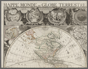
Mappe monde, ou globe terrest…
Pas kaart van de zee kusten v…
Oud-Groenland, of deszelfs Oo…
A map of Carolina, Florida an…
A map of Dutch settlements of…
Pas-kaart vande Rivieren Comm…
Nieuwe kaart van Suriname : v…
Representation la plus nouvel…
A plan of the city of New Yor…
Carte des Isles de L'Amerique…
Carte de L'Isle de Saint-Domi…
Nette Koerswysing van Amsterd…
De nette koers wysing van de …
Le Ruyavme d Abyssinie ou lem…
L"empire du Monomotapa et la …
Isle de Malthe
Isle de Madagascar dite de St…
Isles dv Cap Verd
I. Goree
Afrique Ancienne
Afrique Moderne
Partie Septentrionale de L'An…
Congo
m
Maps
The Jeannette ; Lost In the I…
A Map or North East and North…
Kaert von Groen-Land, [fold o…
Nova Zembla, p. 101
m
Plano.: de la Ysla de Sn. Jua…
A new map of Africa from the …
Map of Virginia, Maryland and…
A map of New Jersey : from th…
Chart of part of the Coast of…
Plan du port, ville, citadell…
Nova & accuratissima celeberr…
Amerika ĕst nor Ashkharhagrak…
Survey of part of the Grange …
Map and survey of lands of up…
Survey of the Grange of Portm…
Plan of Conewago Canal
m
H.M.S. Aeolus and H.M.S. Norw…
Pennsylvania and Maryland map
m
Township of Franklin situate …
m
Franklinville with privileges…
m
Carte d'une partie de l'Etat …
5) Pennsylvania - Paoli, Ches…
A perspective view of Lake Ge…
A map of the south part of th…
1
2
3
4
5
6
7
8
9
10
11
Previous
Next
1
2
3
4
5
6
7
8
9
10
11
Previous
Next