Click to visit the main New York Public Library Homepage
The New York Public Library
Digital Collections
About Digital Collections
Browse
Search only public domain materials
Items
Collections
Divisions
Home
Search
Browse
About
Search only public domain materials
Items
Collections
Divisions
Digital Collections
Using Images
Using Data
Search
Filtered search
Show filters
Hide filters
Show Only Public Domain
topic
Coasts
2
Nautical charts
2
Colonies
1
name
Aa, Pieter van der, 1659-1733
3
Fisher, William, active 1677-1704
2
Lea, Philip, active 1683-1700
2
Robert de Vaugondy, Didier, 1723-1786
2
Smith, John, 1580-1631
2
More
Less
collection
Lawrence H. Slaughter Collection of English maps, charts, globes, books and atlases
8
Maps of North America
8
I. N. Phelps Stokes Collection of American Historical Prints
2
John H. Levine Collection
1
place
x
Middle Atlantic States
New England
10
Early works to 1800
5
Maps
5
Virginia
5
More
Less
genre
Maps
19
Prints
2
publisher
s.n
2
By Pieter vander Aa
1
Didot
1
Ex officina N. Visscher
1
Ex officina N. Visscher,
1
More
Less
division
Map Division
17
Wallach Division: Print Collection
2
type
cartographic
19
still image
1
Date Range
to
19 results found
Filtering on:
x
Date
: 1684 - 1761
x
Place
: Middle Atlantic States
Sort by:
Title
Date created
Date digitized
Sequence
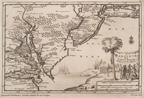
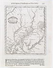
D'Engelze volkplanting in Vir…
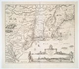
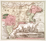
Novi Belgii Novaeque Angliae …
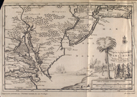
D'Engelze volkplanting in Vir…
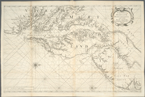
Part of North America: compre…
Virginia, Maryland, Pennsilva…
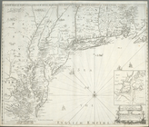
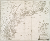
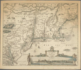
A new map of New England, New…
Virginia, Maryland, Pennsilva…
A new map of New Jarsey and P…
Belgii novi, angliae novae, e…
D'Engelze volkplanting in Vir…
A new map of the most conside…
Nouvelle Angleterre, Nlle. Yo…
Carte de la Nouvelle Angleter…
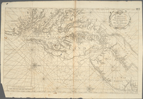
An accurate map of the Englis…
m
A map of the most inhabited p…
An accurate map of Canada, wi…
A new map of New England, New…
Recens edita totius Novi Belg…
Novi Belgii Novaeque Angliae …
End of results
|
Top