Click to visit the main New York Public Library Homepage
The New York Public Library
Digital Collections
About Digital Collections
Browse
Search only public domain materials
Items
Collections
Divisions
Home
Search
Browse
About
Search only public domain materials
Items
Collections
Divisions
Digital Collections
Using Images
Using Data
Search
Filtered search
Show filters
Hide filters
Show Only Public Domain
topic
Colonies
8
Geography
2
Discovery and exploration
1
Le Maire Strait (Argentina)
1
name
Moll, Herman, -1732
6
Childe, Timothy
5
Bowles, John, 1701-1779
2
Churchill, John
2
Falconer, Robert, active 1700
2
More
Less
collection
Lawrence H. Slaughter Collection of English maps, charts, globes, books and atlases
8
Maps of North America
3
John H. Levine Collection
2
Maps of North and South America
2
I. N. Phelps Stokes Collection of American Historical Prints
1
place
x
America
North America
9
Great Britain
6
France
2
Africa
1
More
Less
genre
Maps
16
Prints
1
publisher
J. Bowles
2
Printed for Timothy Childe at the White Hart at the West-end of St. Paul's Church-yard
2
Printed for and [sic] J. Churchil, in Pater-Noster-Row and T. Childe in St. Paul's Church-yard,
2
A. and J. Churchil and T. Childe
1
By Philip Lea, at ye Atlas and Hercules in Cheap-side, and by I. Overton at the White Horse without Newgat
1
More
Less
division
Map Division
15
Wallach Division: Print Collection
1
type
cartographic
16
Date Range
to
16 results found
Filtering on:
x
Date
: 1690 - 1725
x
Place
: America
Sort by:
Title
Date created
Date digitized
Sequence
The isle of California, New M…
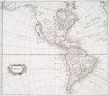
A new mapp of America: devid…
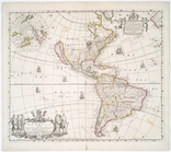
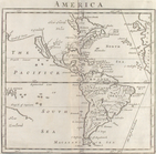
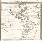
America
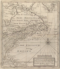
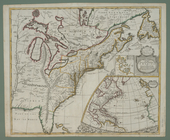
The English empire in America…
America
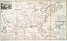
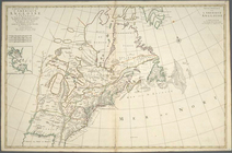
A new map of the English empi…
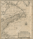
A new map of the north parts …
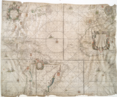
America.
The English empire in America…
A new map of the most conside…
A new map of the north parts …
West-Indische paskaert....
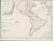
L'Amerique, ou, Le nouveau co…
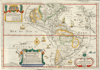
L'Amerique meridionale et sep…
Carte nouvelle de l'Amerique …
A new map of the English empi…
End of results
|
Top