Click to visit the main New York Public Library Homepage
The New York Public Library
Digital Collections
About Digital Collections
Browse
Search only public domain materials
Items
Collections
Divisions
Home
Search
Browse
About
Search only public domain materials
Items
Collections
Divisions
Digital Collections
Using Images
Using Data
Search
Filtered search
Show filters
Hide filters
Show Only Public Domain
topic
Atlases, British
1
Caribbean Americans
1
Cherokee Indians
1
Early works to 1800
1
History
1
More
Less
name
Moll, Herman, -1732
3
Anville, Jean Baptiste Bourguignon d', 1697-1782
2
Bowles, John, 1701-1779
2
Cóvens et Mortier
2
Haye, G. de la
2
More
Less
collection
Maps of North America
6
Lawrence H. Slaughter Collection of English maps, charts, globes, books and atlases
4
place
x
Southern States
Louisiana
5
Florida
4
Georgia
3
North Carolina
3
More
Less
genre
Maps
10
publisher
Chez Cóvens & Mortier
2
Sr. d'Anville
2
And sold by him [Herman Moll], over-against Devereux-Court, between Temple-Bar and St. Clements's-Church in the Strand,
1
For R. Baldwin
1
Printed for Thos. Bowles & John Bowles
1
More
Less
division
Map Division
10
type
cartographic
10
Date Range
to
10 results found
Filtering on:
x
Date
: 1701 - 1763
x
Place
: Southern States
Sort by:
Title
Date created
Date digitized
Sequence
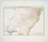
Carolina
Carte de la Louisiane
Carte de la Louisiane
A map of the new governments …
Florida, called by ye French …
A new map of the Cherokee Nat…
Carte de la Louisiane, Maryla…
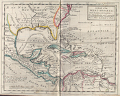
A map of the West-Indies &c. …
Part of North America: compre…
Carte de la Louisiane, Maryla…