Click to visit the main New York Public Library Homepage
The New York Public Library
Digital Collections
About Digital Collections
Browse
Search only public domain materials
Items
Collections
Divisions
Home
Search
Browse
About
Search only public domain materials
Items
Collections
Divisions
Digital Collections
Using Images
Using Data
Search
Filtered search
Show filters
Hide filters
Show Only Public Domain
topic
Landowners
35
Real property
33
Maps
26
History
11
Administrative and political divisions
3
More
Less
name
Alexander, James, 1691-1756
6
Eaton, J. H. (Paymaster)
2
United States. Army of the Cumberland
2
United States. Army. Corps of Topographical Engineers
2
Abert, J. W. (James William), 1820-1897
1
More
Less
collection
Maps of North America
54
Maps of New York City and State
17
Maps of property in the city of New York belonging to John J. Astor Esq
1
Maps of the Arctic Regions
1
place
New Jersey
26
New York (State)
12
Cobb County (Ga.)
7
Georgia
7
United States
6
More
Less
genre
x
Manuscript maps
Maps
73
Surveys
24
Cadastral maps
11
Facsimiles
2
More
Less
publisher
producer not identified
18
Corps of Topographical Engineers
2
J.H. Eaton
2
publisher not identified
2
Common Council
1
More
Less
division
Map Division
72
No Division
1
type
cartographic
73
text
1
Date Range
to
73 results found
Filtering on:
x
Date
: 1705 - 1864
x
Genre
: Manuscript maps
Sort by:
Title
Date created
Date digitized
Sequence
m
Maps of property in the city …
m
Mercator projection exhibitin…
Property in the towns of Cast…
Map of property in the 19th w…
Subdivision of Block 5 of the…
Parts of Ohio & Pennsylvania …
A Tracing of parts of the sta…
Sketch of the battle ground a…
Sketch of the battle ground a…
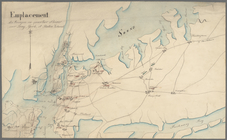
Emplacement des troupes en qu…
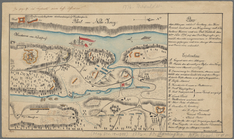
Plan der Attaque, welche Sr. …
Military map of South Carolina
Land given to the town of Qui…
Map of Gloucester Co., Va.
m
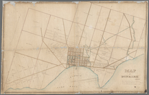
Map of Dunkirk
Massachusetts with Connecticu…
New Jersey
Map of the lateral rail roads…
The route of the army under t…
m
Three maps of the property kn…
Country-seat of Danl. P. Barn…
Map of New York, New England,…
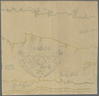
Pencil sketch of Rochester, N…
m
Map of Long Island and adjace…
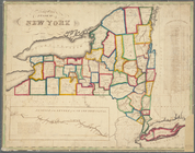
Map of the State of New York
Distribution of his majesty's…
Map of field of occupation, A…
Map shewing position of 1st B…
Information map, Hd. Qrs. 20 …
Information map, Hd. Qrs, 20t…
Manuscript map of northwester…
m
M. Stacy 1000 a. (survey of M…
m
Draughts of land in Amwell in…
m
A plan of 8 acres land survey…
m
Jon. Biddle's draught on Assu…
m
Coll. John Bryerly's draught …
m
Jon. Jewel's draught for 105 …
m
Draught of 8 3/4 acres of lan…
m
Draught of 1855 acres lying u…
m
Saml. Devenport & Elizath. Ro…
m
Charls Reed's survey & draugh…
m
Draught of Gidion's Bickerdik…
m
James Freese's mapp of his lo…
m
Coppy of M. Stacys survey, 13…
m
Mahlon Wright's draft of 86 a…
m
John Biddle's survey of 472 a…
m
John Biddle's survey of 219 a…
m
Saml. Devenports draught & su…
m
Saml. Devenports tract as ye …
m
Jos. Kirkbrid's 1250 acre tra…