Click to visit the main New York Public Library Homepage
The New York Public Library
Digital Collections
About Digital Collections
Browse
Search only public domain materials
Items
Collections
Divisions
Home
Search
Browse
About
Search only public domain materials
Items
Collections
Divisions
Digital Collections
Using Images
Using Data
Search
Filtered search
Show filters
Hide filters
Show Only Public Domain
topic
Nautical charts
10
Coasts
2
Cod fisheries
2
Magnetic declination
2
Trade routes
2
More
Less
name
L'Isle, Guillaume de, 1675-1726
6
Bellin, Jacques Nicolas, 1703-1772
5
Sayer, Robert, 1725-1794
5
Fry, Joshua, approximately 1700-1754
4
Jefferson, Peter, 1708-1757
4
More
Less
collection
Maps of North America
34
Lawrence H. Slaughter Collection of English maps, charts, globes, books and atlases
23
Maps of the Oceans
3
The Eno collection of New York City views
3
Atlases, gazetteers, guidebooks and other books
1
More
Less
place
x
Maps
Early works to 1800
65
North America
19
America
12
Virginia
11
More
Less
genre
Maps
69
Prints
3
publisher
s.n
6
s.n.,
5
Sold by H. Moll over against Deverux Court in ye Strand ...,
2
... published ... by J.F.W. Des Barres esqr
1
... I. Bew, Pater Noster Row
1
More
Less
division
Map Division
63
Schomburg Jean Blackwell Hutson Research and Reference Division
5
Wallach Division: Print Collection
3
type
cartographic
69
still image
2
text
1
Date Range
to
71 results found
Filtering on:
x
Date
: 1720 - 1780
x
Place
: Maps
Sort by:
Title
Date created
Date digitized
Sequence
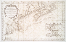
Coste d'Afrique et les Isles …
Carte de la Virginie et du Ma…
America Septentrionalis conci…
Amerique septentrionale : sui…
A plan of Fort Montgomery & F…
A Plan of the city and enviro…
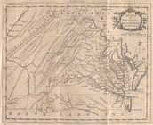
A new map of Virginia, Mary-l…
Virginie, Maryland : en 2 feu…
A New and correct chart of th…
A chart of the Atlantic Ocean…
Carte du Canada et de la Loui…
Canada et Louisiane
Carte reduite des costes orie…
A chart of Delawar River from…
Hemisphere occidental dresse …
Carte d'Amerique, divisées en…
A new map of the whole contin…
This map of North America acc…
A new map of Virginia from th…
A chart of Delawar Bay : with…
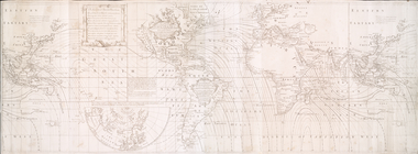
Accuratissima totius terrarum…
America.
Carte de la Louisiane, Maryla…
This map of North America acc…
m
Oyster Bay and Huntington, Hu…
La Pensilvania, la Nuova York…
Carte du theatre de la guerre…
A New and accurate map of the…
A chart of Delaware Bay and R…
A new map of Virginia : from …
Virginia and Maryland
D'Engelze volkplanting in Vir…
Partie de l'Amerique septentr…
Amérique septentrionale : dre…
Map of Spanish Louisiana and …
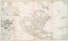
An exact map of North and Sou…
An accurate map of North Amer…
Carte générale de l'Amérique …
Nouvelle Angleterre, Nlle. Yo…
An accurate map of the Englis…
Schauplatz des Kriegs zwische…
Carta della Nuova Inghilterra…
A map of the most inhabited p…
A New and accurate map of Vir…
m
A map of the most inhabited p…
North America, agreeable to t…
North America, as divided amo…
Carte réduite des côtes orien…
A new and correct map of Nort…
An Accurate map of the presen…