Click to visit the main New York Public Library Homepage
The New York Public Library
Digital Collections
About Digital Collections
Browse
Search only public domain materials
Items
Collections
Divisions
Home
Search
Browse
About
Search only public domain materials
Items
Collections
Divisions
Digital Collections
Using Images
Using Data
Search
Filtered search
Show filters
Hide filters
Show Only Public Domain
topic
Coasts
1
Nautical charts
1
name
Robert de Vaugondy, Didier, 1723-1786
2
Bellin, Jacques Nicolas, 1703-1772
1
Fisher, William, active 1677-1704
1
Fry, Joshua, approximately 1700-1754
1
Hinton, John, d. 1781
1
More
Less
collection
Maps of North America
5
Lawrence H. Slaughter Collection of English maps, charts, globes, books and atlases
2
place
x
Middle Atlantic States
Early works to 1800
3
Maps
3
New England
3
Northeastern States
2
More
Less
genre
Maps
7
publisher
s.n
2
Didot
1
Printed for Robt. Sayer at No. 53 in Fleet Street, & Thos. Jefferys at the corner of St. Martins Lane, Charing Cross
1
Sold by William Mount & Thos. Page
1
Univers. Mag., J. Hinton, Newgate Street
1
More
Less
division
Map Division
7
type
cartographic
7
Date Range
to
7 results found
Filtering on:
x
Date
: 1740 - 1765
x
Place
: Middle Atlantic States
Sort by:
Title
Date created
Date digitized
Sequence
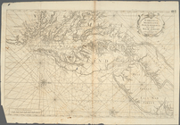
Part of North America: compre…
Virginia, Maryland, Pennsilva…
Nouvelle Angleterre, Nlle. Yo…
Carte de la Nouvelle Angleter…
An accurate map of the Englis…
m
A map of the most inhabited p…
An accurate map of Canada, wi…