Click to visit the main New York Public Library Homepage
The New York Public Library
Digital Collections
About Digital Collections
Browse
Search only public domain materials
Items
Collections
Divisions
Home
Search
Browse
About
Search only public domain materials
Items
Collections
Divisions
Digital Collections
Using Images
Using Data
Search
Filtered search
Show filters
Hide filters
Show Only Public Domain
topic
x
Maps
Landowners
17
Real property
17
History
8
Administrative and political divisions
5
More
Less
name
Homann, Johann Baptist, 1663-1724
30
Chauchard, Captain
28
Gillet, Thomas
28
Neele, Samuel John, 1758-1824
28
Stockdale, John, 1749?-1814
28
More
Less
collection
Atlases, gazetteers, guidebooks and other books
61
Maps of North America
27
Maps of New York City and State
9
The history of Japan, giving an account of the ancient and present state and government of that empire [...] Together with a description of the kingdom of Siam: giving an account of the ancient and present state and government of that empire; of its temples, palaces, castles, and other buildings; of its metals, minerals, trees, plants, animals, birds and fishes; of the chronology and succession of the emperors ... of the original descent, religions, customs, and manufactures of the natives, and of their trade and commerce with the Dutch and Chinese. Together with a description of the kingdom of Siam
5
Description de l'Égypte: ou, Recueil des observations et des recherches qui ont été faites en Égypte pendant l'expédition de l'armée française
4
More
Less
place
Switzerland
30
Italy
29
Europe
28
New Jersey
17
New York (State)
8
More
Less
genre
Maps
109
Manuscript maps
18
Surveys
17
Illustrations
8
Prints
4
More
Less
publisher
Printed for John Stockdale, Piccadilly. T. Gillett, Printer, Salisbury Square
28
The translator
5
A. Bertrand
4
Impr. impériale
4
Printed for Robt. Sayer & Jno. Bennett
2
More
Less
division
Map Division
97
General Research Division
6
Rare Book Division
5
Schomburg Manuscripts, Archives and Rare Books Division
4
type
cartographic
108
text
4
still image
3
Date Range
to
112 results found
Filtering on:
x
Date
: 1749 - 1828
x
Topic
: Maps
Sort by:
Title
Date created
Date digitized
Sequence
A map of Barbary comprehendin…
Map of New Haven and its envi…
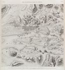
An exact map of the five grea…
A new map of the Cherokee Nat…
Part of North America, contai…
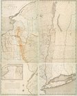
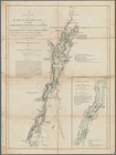
A survey of Lake Champlain: i…
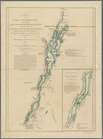
A survey of Lake Champlain: i…
Distribution of his majesty's…
A map of part of the N. W. Te…
An accurate map of the Distri…
A map of the district of Main…
m
M. Stacy 1000 a. (survey of M…
m
Draughts of land in Amwell in…
m
Jon. Biddle's draught on Assu…
m
Coll. John Bryerly's draught …
m
Jon. Jewel's draught for 105 …
m
Draught of 1855 acres lying u…
m
Saml. Devenport & Elizath. Ro…
m
Charls Reed's survey & draugh…
m
Draught of Gidion's Bickerdik…
m
James Freese's mapp of his lo…
m
Coppy of M. Stacys survey, 13…
m
Mahlon Wright's draft of 86 a…
m
John Biddle's survey of 472 a…
m
John Biddle's survey of 219 a…
m
Saml. Devenports draught & su…
m
Saml. Devenports tract as ye …
m
Saml. Devenports mapp of his …
A general map of the southern…
Île d'Éléphantine et Syène [A…
Erment [Armant] et environs (…
Égypte Moyenne. 1-28. Plan et…
Déserts arabiques. 1. Carte d…
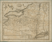
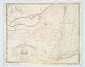
Map of the State of New York …
State of New York, Jany. 1, 1…
A map of the state of New Yor…
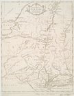
Map of the State of New York
An Accurate map of New York i…
m
Map of the state of New York
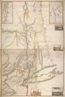
Province de New-York : en 4 f…
Map of the southern provinces…
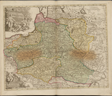
La Pologne, Plate 19
Index Map
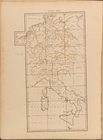
A general map of the empire o…
To the King's Most Excellent …
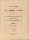
Plate I: A general map of the…
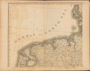
Plate II: A general map of th…
Plate III: A general map of …
Plate IV: A general map of t…
Plate V: A general map of the…