Click to visit the main New York Public Library Homepage
The New York Public Library
Digital Collections
About Digital Collections
Browse
Search only public domain materials
Items
Collections
Divisions
Home
Search
Browse
About
Search only public domain materials
Items
Collections
Divisions
Digital Collections
Using Images
Using Data
Search
Filtered search
Show filters
Hide filters
Show Only Public Domain
topic
Maps
9
Geography, Ancient
5
Nautical charts
5
Coasts
2
Harbors
2
More
Less
name
Homann, Johann Baptist, 1663-1724
8
Bellin, Jacques Nicolas, 1703-1772
7
Anville, Jean Baptiste Bourguignon d', 1697-1782
5
Choiseul, Etienne-François, duc de, 1719-1785
3
Bowen, Emanuel, 1693 or 1694-1767
2
More
Less
collection
Bancker plans
11
Atlases, gazetteers, guidebooks and other books
8
Maps of North America
8
Wonders: Images of the Ancient World
5
John H. Levine Collection
2
More
Less
place
Italy
9
Switzerland
8
Florida
3
Louisiana
3
United States
3
More
Less
genre
x
Maps
Surveys
11
Documents
6
land surveys
5
Bathymetric maps
1
More
Less
publisher
Depost des cartes, plans et journaux de la marine
2
publisher not identified
2
Bellin
1
Dan Paterson
1
Dépost des cartes de la marine?
1
More
Less
division
Map Division
22
Manuscripts and Archives Division
11
Wallach Division: Picture Collection
5
Rare Book Division
2
General Research Division
1
More
Less
type
cartographic
43
text
7
still image
1
Date Range
to
43 results found
Filtering on:
x
Date
: 1764 - 1767
x
Genre
: Maps
Sort by:
Title
Date created
Date digitized
Sequence
Pennsylvania and Maryland map
Plan de la ville Tartare de P…
Orbis romani pars orientalis
Tabula Italiæ antiquæ geograp…
La Palestine
Ægyptus antiqua : Mandato ser…
Asiæ, quæ vulgo Minor dicitur…
A draught of Port Royal Harbo…
Carte reduite des costes de l…
A draught of West Florida : f…
m
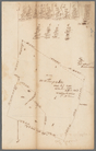
Land cleared near Mr. Apthorp…
m
Church and Rutgers
m
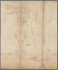
Tract divided for Peter Remsen
m
Road near Scott's
m
Colonel De Lancey's cleared l…
m
Oliver De Lancey near Trinity…
m
Yellis Mandeville 65 acres ne…
m
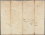
Survey of the cove at Corlear…
m
Penet
m
Piece of ground near the ston…
m
Cleared ground - Colonel De L…
Louisiana, as formerly claime…
Plan de la Baye de Pensacola …
A new and accurate map of eas…
Distribution of his majesty's…
Égypte nommée dans le pays Mi…
Ville de Manathe ou Nouvelle-…
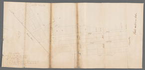
A draught of New York from th…
North America
A plan of the city of New-Yor…
A new and accurate map of Afr…
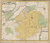
Canton Zürich sire Illustris …
Canton Bern sive illustris He…
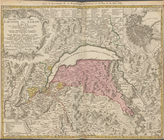
Canton Schweiz sive Pagus Hel…
Canton Unterwalden sive Pagus…
Canton Freiburg sive Pagus He…
Canton Solothurn sive pagus H…
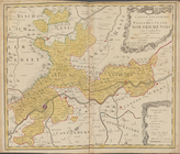
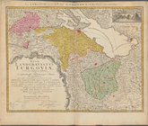
Nova landgraviatus Turgovia c…
Novissima totius Lausonii siv…
Carte réduite de l'Ocean occi…
Carte réduite de l'Ocean occi…
Carte de la Nouvelle Angleter…
Carte des variations de la bo…
End of results
|
Top