Click to visit the main New York Public Library Homepage
The New York Public Library
Digital Collections
About Digital Collections
Browse
Search only public domain materials
Items
Collections
Divisions
Home
Search
Browse
About
Search only public domain materials
Items
Collections
Divisions
Digital Collections
Using Images
Using Data
Search
Filtered search
Show filters
Hide filters
Show Only Public Domain
topic
History
25
Nautical charts
11
Long Island, Battle of, New York, N.Y., 1776
10
Buildings, structures, etc
6
City & town life
3
More
Less
name
Faden, William, 1749-1836
13
Kitchin, Thomas, 1718-1784
8
Eno, Amos F., 1836-1915
6
Fisher, Joshua, 1707-1783
5
Des Barres, Joseph F. W. (Joseph Frederick Wallet), 1729-1824
4
More
Less
collection
Lawrence H. Slaughter Collection of English maps, charts, globes, books and atlases
16
Maps of New York City and State
15
Emmet Collection of Manuscripts Etc. Relating to American History
13
I. N. Phelps Stokes Collection of American Historical Prints
10
Wallach Division Picture Collection
8
More
Less
place
x
New York (N.Y.)
New York (State)
21
New Jersey
17
New York
14
Long Island (N.Y.)
8
More
Less
genre
Maps
45
Prints
31
Drawings
3
Early works to 1800
3
Photographs
3
More
Less
publisher
Printed for R. Baldwin
3
Wm. Faden
3
... publish'd by Wm. Faden, successor to the late Mr. Ts. Jefferys, geographer to the King, Charing Cross,
2
Faden, William
2
Jefferys & Faden
2
More
Less
division
Map Division
37
Wallach Division: Print Collection
29
Wallach Division: Picture Collection
5
Manuscripts and Archives Division
1
Milstein Division
1
More
Less
type
cartographic
45
still image
31
text
4
Date Range
to
77 results found
Filtering on:
x
Date
: 1776 - 1784
x
Place
: New York (N.Y.)
Sort by:
Title
Date created
Date digitized
Sequence
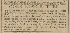
Cork Rose Butter
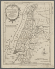
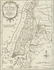
A chorographical map of the P…
Grundriss des nördlichen Thei…
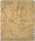
A plan of New York Island, pa…
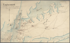
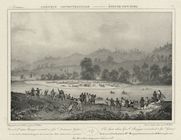
Emplacement des troupes en qu…
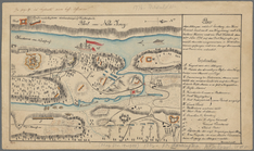
Plan der Attaque, welche Sr. …
Military adjacent to the Baya…
The spot where Genal. Burgoyn…
First reading of the Declarat…
New York in 1776 (from the No…
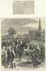
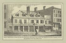
Burns' Coffee House, in which…
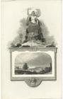
Allegorical border with view …
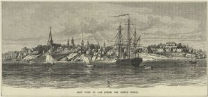
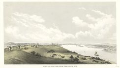
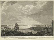
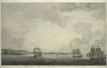
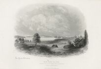
View of New York from the nor…
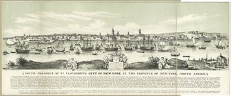
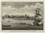
A south prospect of ye flouri…
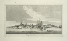
A south west view of the City…
Bowles's new pocket map of th…
The country twenty five miles…
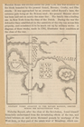
A chart of New York Harbour :…
[A chart of New York Island &…
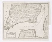
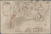
A Plan of the city and enviro…
A chart of Delaware Bay and R…
A chart of Delaware Bay and R…
Baye de la Delaware avec les …
A chart of Delawar River from…
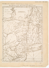
A Map of the country round Ph…
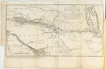
Carte de la route des lacs de…
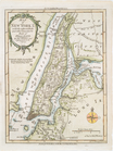
Map of New York I. : with the…
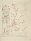
A plan of New York Island, wi…
Theatre de la guerre en Améri…
A chart of Delaware Bay and R…
A chart of New York Island & …
The Country twenty five miles…
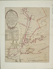
A plan of New York Island, wi…
A chart of the bar of Sandy H…
An accurate map of Staten Isl…
To His Excellency Sr. Henry M…
Map of Hudson's River, with t…
An accurate map of Staten Isl…
Map of New York I. : with the…
m
Map of New York I. : with the…
Chart and plan of the harbour…
A plan of New York Island, wi…
South west view of Fort Georg…
An original sketch by an Engl…
New York in 1768 from the rea…
New York
A map of the country in which…
A map of the provinces of New…
A view of New York from the n…
A plan of New York island, wi…