Click to visit the main New York Public Library Homepage
The New York Public Library
Digital Collections
About Digital Collections
Browse
Search only public domain materials
Items
Collections
Divisions
Home
Search
Browse
About
Search only public domain materials
Items
Collections
Divisions
Digital Collections
Using Images
Using Data
Search
Filtered search
Show filters
Hide filters
Show Only Public Domain
topic
Nautical charts
3
Coasts
1
name
Lodge, John, -1796
3
Bew, John, -1793
2
Des Barres, Joseph F. W. (Joseph Frederick Wallet), 1722-1824
2
Anville, Jean Baptiste Bourguignon d', 1697-1782
1
Bew, John, d. 1793
1
More
Less
collection
Maps of North America
10
Lawrence H. Slaughter Collection of English maps, charts, globes, books and atlases
7
Maps of the Oceans
1
place
x
Early works to 1800
Maps
18
New Jersey
3
United States
3
History
2
More
Less
genre
Maps
18
publisher
... published ... by J.F.W. Des Barres esqr
1
... I. Bew, Pater Noster Row
1
A. Zatta
1
Chez Esnauts et Rapilly, rue St. Jacques à la Ville de Coutances,
1
Chéz Le Rouge, ing? géographe du Roi, Rue des Grands Augustins
1
More
Less
division
Map Division
18
type
cartographic
18
Date Range
to
18 results found
Filtering on:
x
Date
: 1777 - 1783
x
Place
: Early works to 1800
Sort by:
Title
Date created
Date digitized
Sequence
A plan of Fort Montgomery & F…
Amerique septentrionale : sui…
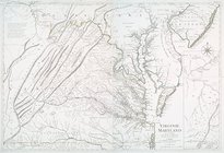
Virginie, Maryland : en 2 feu…
A chart of Delawar River from…
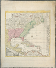
A new map of the whole contin…
Carte de la Nouvelle York : y…
A chart of Delawar Bay : with…
La Pensilvania, la Nuova York…
Carte du theatre de la guerre…
A New and accurate map of the…
An exact map of North and Sou…
The United States of North Am…
A New and accurate map of Vir…
A map of the United States of…
Carte réduite des côtes orien…
A new and correct map of Nort…
Plan of the city of Washingto…
A new map or chart in Mercato…
End of results
|
Top