Click to visit the main New York Public Library Homepage
The New York Public Library
Digital Collections
About Digital Collections
Browse
Search only public domain materials
Items
Collections
Divisions
Home
Search
Browse
About
Search only public domain materials
Items
Collections
Divisions
Digital Collections
Using Images
Using Data
Search
Filtered search
Show filters
Hide filters
Show Only Public Domain
topic
History
15
Slavery
13
African Americans
9
Railroads
7
Enslaved persons
6
More
Less
name
Palmer, J. A
24
American Civil War (1861-1865)
7
Brooke, William Henry, 1772-1860
6
Lindenkohl, A
3
Lindenkohl, H. (Henry)
3
More
Less
collection
Maps of North America
28
Robert N. Dennis collection of stereoscopic views
24
Wallach Division Picture Collection
11
The slave states of America
8
Lawrence H. Slaughter Collection of English maps, charts, globes, books and atlases
3
More
Less
place
x
Southern States
South Carolina
26
United States
24
Confederate States of America
6
Georgia
3
More
Less
genre
Maps
33
Photographs
28
Stereographs
24
Illustrations
9
Prints
7
More
Less
publisher
J. A. Palmer
24
Fisher, Son & Co
8
H.H. Lloyd & Co
2
John Cassell
2
U.S. Coast Survey, A.D. Bache, Supdt
2
More
Less
division
Map Division
31
Wallach Division: Photography Collection
25
Wallach Division: Picture Collection
11
Schomburg Manuscripts, Archives and Rare Books Division
8
Schomburg Photographs and Prints Division
5
More
Less
type
still image
52
cartographic
33
text
7
Date Range
to
87 results found
Filtering on:
x
Date
: 1783 - 1869
x
Place
: Southern States
Sort by:
Title
Date created
Date digitized
Sequence
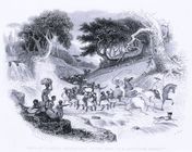
Gang of slaves journeying to …
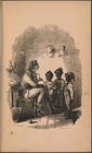
The Schoolmaster
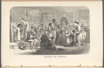
Teaching the Freedmen
Eastern Tennessee, with parts…
Map of Virginia, part of West…
Colton's map of Virginia, Mar…
Plan of the siege of York Tow…
Map of Mississippi, Louisiana…
Florida, with the march of He…
Map of the southern parts of …
Map of the southern states to…
Map of the east coast of the …
m
Map of the states of North Ca…
Map of the present theatre of…
Perrine's new topographical w…
m
Colton's map of the southern …
The United States, southern p…
Lloyd's new military map of t…
Map of the Southern States, i…
Lloyd's map of the Southern S…
Lloyd's new military map of t…
Map showing the distribution …
Plan of the western seat of w…
A new military map of the sea…
Map of the seat of war to acc…
Extract from a map entitled P…
m
No. XXIII. Pine barren of the…
G. Woolworth Colton's map of …
Map of reconnaissance exhibit…
Map of the southern parts of …
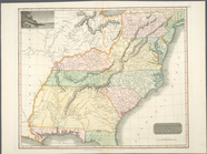
Southern provinces of the Uni…
New map of the states of Geor…
The marches of Lord Cornwalli…
m
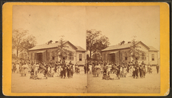
Colored School.
m
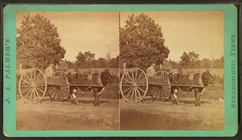
Cracker cart.
m
Ox cart.
m
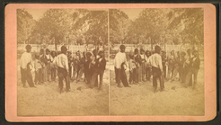
Flip-flap militia.
m
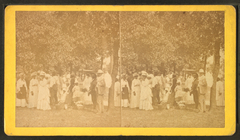
Fourth of July 1874.
m
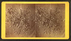
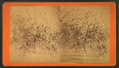
Mistletoe.
m
Mistletoe.
m
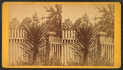
Spanish bayonet.
m
Spanish bayonet in bloom.
m
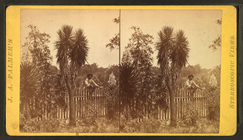
Cotton plant.
m
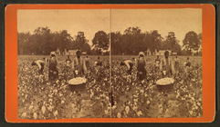
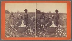
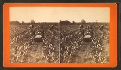
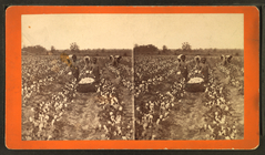
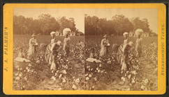
Cotton field.
m
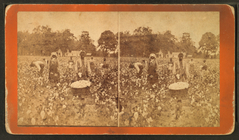
Cotton field.
m
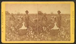
Cotton field.
m
Cotton field.
m
Cotton field.
m
Cotton field.
m
Cotton field.