Click to visit the main New York Public Library Homepage
The New York Public Library
Digital Collections
About Digital Collections
Browse
Search only public domain materials
Items
Collections
Divisions
Home
Search
Browse
About
Search only public domain materials
Items
Collections
Divisions
Digital Collections
Using Images
Using Data
Search
Filtered search
Show filters
Hide filters
Show Only Public Domain
collection
Bancker plans
32
genre
x
Surveys
Maps
28
land surveys
28
Documents
5
division
Manuscripts and Archives Division
32
type
cartographic
28
text
5
Date Range
to
32 results found
Filtering on:
x
Date
: 1795 - 1797
x
Genre
: Surveys
Sort by:
Title
Date created
Date digitized
Sequence
m
Beaver Street and New Street
m
Bowery Lane
m
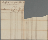
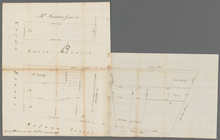
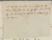
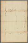
Mathew Buys land in five equa…
m
Lots on Bowery Lane
m
Between Whitehall and Coentie…
m
Herring farm along Skinner Ro…
m
Ann and Nassau Streets
m
State Prison
m
State Prison
m
King's farm and Mr. Embree's …
m
Ann White's estate known by t…
m
Orange Street opening
m
Form of charter officers poll…
m
The late John Quackenboss's e…
m
Lots between Delancey and Riv…
m
Van Der Spiegel's lot in Ston…
m
South Street between White Ha…
m
Pearl Street near Rutgers and…
m
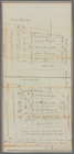
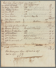
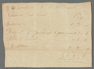
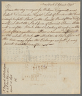
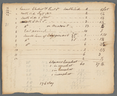
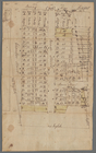
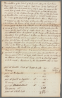
Bill from Mr. Ryan
m
Samuel Ellis between Washingt…
m
Courses between Ridgener's Me…
m
State Prison lot on Hudson Ri…
m
Annos's ground, Greenwich and…
m
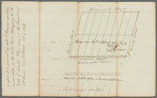
Greenwich Street to Hudson Ri…
m
Abraham Duryee at Horn's Hook
m
Horn's Hook
m
Church lots on the north side…
m
Gould Street near Maiden Lane
m
N. Bayard's lots contiguous t…
m
West side of Great George Str…
m
Negroes Burying Ground, Kip […
m
Extent of intended grants in …
End of results
|
Top