Click to visit the main New York Public Library Homepage
The New York Public Library
Digital Collections
About Digital Collections
Browse
Search only public domain materials
Items
Collections
Divisions
Home
Search
Browse
About
Search only public domain materials
Items
Collections
Divisions
Digital Collections
Using Images
Using Data
Search
Filtered search
Show filters
Hide filters
Show Only Public Domain
topic
History
15
Description and travel
5
Nautical charts
5
Administrative and political divisions
4
Middle Atlantic States
4
More
Less
name
Jomard, M. (Edme-François), 1777-1862
20
Napoleon I, Emperor of the French, 1769-1821
20
Lewis, Samuel, 1753 or 1754-1822
14
Thomas & Andrews
7
Cary, John, approximately 1754-1835
6
More
Less
collection
Bancker plans
255
Maps of North America
39
Description de l'Égypte: ou, Recueil des observations et des recherches qui ont été faites en Égypte pendant l'expédition de l'armée française
20
Lawrence H. Slaughter Collection of English maps, charts, globes, books and atlases
18
Maps of New York City and State
13
More
Less
place
Egypt
25
United States
11
New York (N.Y.)
10
Maps
9
New York (State)
9
More
Less
genre
x
Maps
Surveys
255
land surveys
215
Documents
42
Prints
12
More
Less
publisher
Impr. impériale
20
C.P. Wayne
5
G. Tofani
5
publisher not identified
5
C. P. Wayne
3
More
Less
division
Manuscripts and Archives Division
256
Map Division
77
Rare Book Division
20
General Research Division
5
Schomburg Manuscripts, Archives and Rare Books Division
3
More
Less
type
cartographic
367
text
45
still image
4
Date Range
to
370 results found
Filtering on:
x
Date
: 1803 - 1812
x
Genre
: Maps
Sort by:
Title
Date created
Date digitized
Sequence
Plan of the town of Paramarib…
m
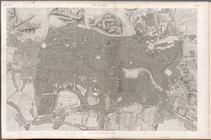
A New and Accurate Map of the…
Ancient Italy
Countries adjacent to the Med…
Environs du Kaire [Cairo]. Pl…
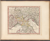
South Germany and Upper Italy…
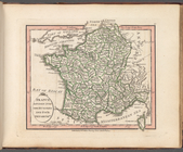
France divided into one hundr…
m
Le Kaire: Plan particulier de…
Plan of private claims in Mic…
m
Hendrick's lot in Beaver Stre…
m
Beaver Street and Petticoat L…
m
Batavia Lane
m
Bowery Lane
m
Bowery Lane between Stanton a…
m
Bowery Lane
m
Lots along Prince, Bowery and…
m
Plot on Bowery lane
m
Bloomingdale - four mile stone
m
Bloomingdale Road to the Comm…
m
Anthony Street
m
Lots near Amity Street, Broad…
m
Abbington and Fitzroy Roads
Plan of the siege of Charlest…
m
Pump, Eagle, Second, Third, F…
m
Pine Street from Pearl Street…
m
1810 January 8
m
1810 January 7
m
Ann and Nassau Streets
m
Between Lispenard and Leonard…
m
James Roosevelt at Harlem
m
Hellgate Road
m
Number 5 Hudson Street yard a…
m
Plan of a House at Number 5 H…
m
Thomas B. Clark's ground at G…
m
Colonel Magregor's at Greenwi…
m
Greenwich Street between Dyes…
m
College ground and lots
m
Malleshaw's near Fresh Water
m
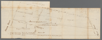
Cherry from George to Rutgers
m
Cherry to Water Street
m
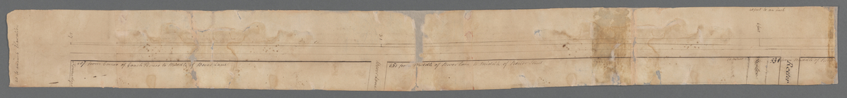
Sketches showing grades and d…
m
Hopper's meadow, Slange, west…
m
Map of 367 acres - Giles to L…
m
Land sold to Lamb
m
Heirs of Robert Carter at Bro…
m
Brookland
m
Computations of Staten Island
m
Staten Isle
m
Copy of a map of land at West…
m
C. and town of Westchester
1
2
Previous
Next
1
2
Previous
Next