Click to visit the main New York Public Library Homepage
The New York Public Library
Digital Collections
About Digital Collections
Browse
Search only public domain materials
Items
Collections
Divisions
Home
Search
Browse
About
Search only public domain materials
Items
Collections
Divisions
Digital Collections
Using Images
Using Data
Search
Filtered search
Show filters
Hide filters
Show Only Public Domain
collection
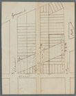
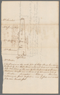
Bancker plans
38
genre
x
Surveys
Maps
34
land surveys
34
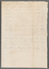
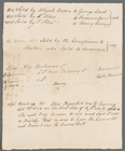
Documents
5
division
Manuscripts and Archives Division
38
type
cartographic
34
text
5
Date Range
to
38 results found
Filtering on:
x
Date
: 1807 - 1809
x
Genre
: Surveys
Sort by:
Title
Date created
Date digitized
Sequence
m
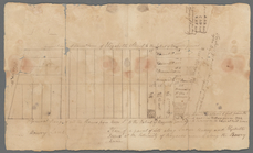
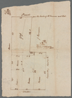
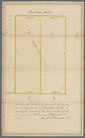
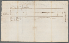
Lots along Prince, Bowery and…
m
Ann and Nassau Streets
m
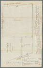
Number 5 Hudson Street yard a…
m
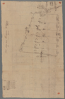
Hopper's meadow, Slange, west…
m
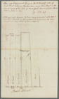
Tivoli calculation for Peter …
m
Broad Street
m
Corner of Reade and Chapel St…
m
Winne and Prince Streets
m
Pearl Street to Water Street
m
Pearl Street
m
Pearl Street
m
Pearl Street
m
Vandewater and Frankfort Stre…
m
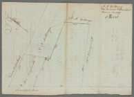
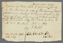
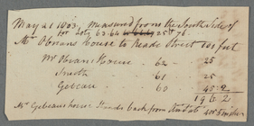
Delancey Street
m
Elm Street
m
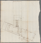
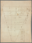
Survey of Slange
m
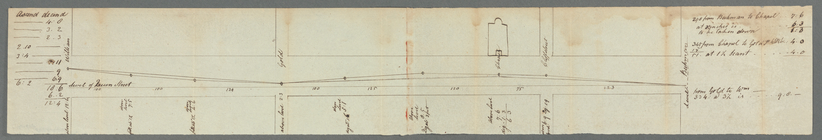
Beekman Street from William t…
m
Southerly side of Partition S…
m
Marketfield Street and Whiteh…
m
House and lot on south side M…
m
Mill Street
m
Maiden Lane
m
Hague Street and Queen Street
m
Hudson Street lots
m
Hudson, Duane, Reade, and Cha…
m
Front Street between Coenties…
m
West side Fourth Street near …
m
North side of Cliff Street
m
Chatham Square
m
Broadway, Leaonard and Benson…
m
Broadway between Courtland an…
m
East side of Broadway
m
Broome Street near Crosby Str…
m
Broome and De Lancey Streets
m
Stringham and Ray
m
Broome, De Lancey Streets, Se…
m
Beekman Street Lot Number 66,…
m
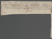
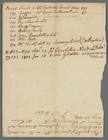
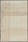
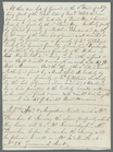
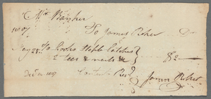
Accounts from James Riker
End of results
|
Top