Click to visit the main New York Public Library Homepage
The New York Public Library
Digital Collections
About Digital Collections
Browse
Search only public domain materials
Items
Collections
Divisions
Home
Search
Browse
About
Search only public domain materials
Items
Collections
Divisions
Digital Collections
Using Images
Using Data
Search
Filtered search
Show filters
Hide filters
Show Only Public Domain
topic
Nautical charts
3
Geography
2
History
2
Landowners
2
Maps
2
More
Less
name
Jomard, M. (Edme-François), 1777-1862
12
Napoleon I, Emperor of the French, 1769-1821
12
Croswell & Frary
2
Fairman, Gideon, 1774-1827
2
Godwin, William, 1756-1836
2
More
Less
collection
Bancker plans
20
Description de l'Égypte: ou, Recueil des observations et des recherches qui ont été faites en Égypte pendant l'expédition de l'armée française
12
Lawrence H. Slaughter Collection of English maps, charts, globes, books and atlases
4
Maps of North America
3
History of Rome: From the building of the city to the ruin of the Republic
2
place
Egypt
12
Cairo (Egypt)
4
Maps
3
Atlantic Coast (U.S.)
2
Elephantine (Egypt)
2
More
Less
genre
x
Maps
Surveys
20
land surveys
20
Illustrations
3
Prints
3
publisher
Impr. impériale
12
Printed by Croswell & Frary
2
Rob[er]t Laurie & James Whittle, No. 53 Fleet Street
2
Published ... by the author ... ,
1
Published as the Act directs ... by William Heather, at the Navigation Warehouse, No. 157, Leadenhall Street,
1
More
Less
division
Manuscripts and Archives Division
20
Rare Book Division
12
Map Division
6
Pforzheimer Collection
2
type
cartographic
39
still image
3
text
2
Date Range
to
41 results found
Filtering on:
x
Date
: 1809 - 1809
x
Genre
: Maps
Sort by:
Title
Date created
Date digitized
Sequence
Ancient Italy
Countries adjacent to the Med…
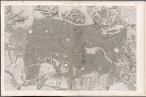
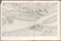
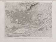
Environs du Kaire [Cairo]. Pl…
m
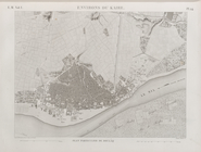
Le Kaire: Plan particulier de…
m
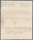
Broad Street
m
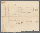
Corner of Reade and Chapel St…
m
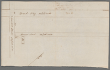
Pearl Street
m
Pearl Street
m
Pearl Street
m
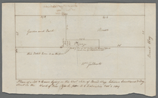
Beekman Street from William t…
m
Southerly side of Partition S…
m
Marketfield Street and Whiteh…
m
Maiden Lane
m
Hague Street and Queen Street
m
Front Street between Coenties…
m
West side Fourth Street near …
m
Chatham Square
m
Broadway, Leaonard and Benson…
m
Broadway between Courtland an…
m
Broome Street near Crosby Str…
m
Broome and De Lancey Streets
m
Stringham and Ray
m
Broome, De Lancey Streets, Se…
m
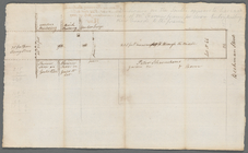
Beekman Street Lot Number 66,…
A plan of Charles town
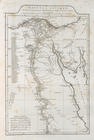
Ægyptus antiqua
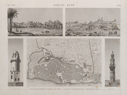
Île de Philæ. Plan général de…
Île d'Éléphantine et Syène [A…
Asouan [Aswân], Esné [Isnâ]. …
Égypte Moyenne. 1-28. Plan et…
Basse Égypte. Carte hydrograp…
Isthme de Soueys [Isthmus of …
Environs de Soueys [Suez]. 1.…
Environs du Kaire [Cairo]. Pl…
Environs du Kaire [Cairo]. Pl…
A new and accurate chart (fro…
A new and accurate chart (fro…
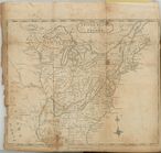
United States or Fredon
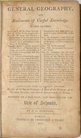
General geography, and rudime…
m
A new chart of the coast of A…
m
A plan of the city of Philade…
End of results
|
Top