Click to visit the main New York Public Library Homepage
The New York Public Library
Digital Collections
About Digital Collections
Browse
Search only public domain materials
Items
Collections
Divisions
Home
Search
Browse
About
Search only public domain materials
Items
Collections
Divisions
Digital Collections
Using Images
Using Data
Search
Filtered search
Show filters
Hide filters
Show Only Public Domain
topic
Enslaved persons
3
Slavery
3
Surveys
3
Antislavery movements
2
Emancipation
2
More
Less
name
United States. Surveyor General of Illinois and Missouri
3
Gamble, Hamilton Rowan, 1798-1864
2
Abert, John James, 1788-1863
1
Anderson, H
1
Brown, William Wells, 1814?-1884
1
More
Less
collection
Maps of North America
14
Slavery resolutions
2
Forty etchings, from sketches made with the camera lucida, in North America, in 1827 and 1828
1
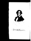
Narrative of William Wells Brown [microform], a fugitive slave. Written by himself
1
place
x
Missouri
Illinois
4
United States
4
Indiana
3
Ohio
3
More
Less
genre
Maps
14
Documents
2
Books
1
Cadastral maps
1
Prints
1
More
Less
publisher
publisher not identified
4
Surveyor's Office
2
s.n
2
Anti-slavery Office
1
Cadell & Co
1
More
Less
division
Map Division
14
Schomburg Manuscripts, Archives and Rare Books Division
2
General Research Division
1
Milstein Division
1
type
cartographic
14
still image
3
text
2
Date Range
to
18 results found
Filtering on:
x
Date
: 1814 - 1848
x
Place
: Missouri
Sort by:
Title
Date created
Date digitized
Sequence
m
Narrative of William Wells Br…
H Diagram of the state of Mis…
Map of the western states to …
m
Missouri
Map of the state of Missouri …
Diagram of the state of Misso…
H. Diagram of the State of Mi…
Missuri
Traveller's map of Michigan, …
m
The travellers pocket map of …
Illinois & Missouri
Iron Mountain City : [Missour…
Map illustrating the plan of …
m
No. XXXIX. Prairie at the con…
A map of Mexico, Louisiana, a…
Western states
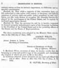
Letter from H.R. Gamble, gove…
Letter from H.R. Gamble, gove…
End of results
|
Top