Click to visit the main New York Public Library Homepage
The New York Public Library
Digital Collections
About Digital Collections
Browse
Search only public domain materials
Items
Collections
Divisions
Home
Search
Browse
About
Search only public domain materials
Items
Collections
Divisions
Digital Collections
Using Images
Using Data
Search
Filtered search
Show filters
Hide filters
Show Only Public Domain
topic
History
84
Forts & fortifications
40
African Americans
32
Fishes
29
United States
23
More
Less
name
Palmer, J. A
47
Nowell, F. A
35
Holbrook, John Edwards, 1794-1871
29
T. Sinclair's Lith
28
Barnard, George N., 1819-1902
27
More
Less
collection
Robert N. Dennis collection of stereoscopic views
267
Wallach Division Picture Collection
95
Maps of North America
48
Ichthyology of South Carolina. Vol. I
29
"The Pageant of America" Collection
12
More
Less
place
x
South Carolina
Charleston (S.C.)
162
Charleston
98
United States
86
Southern States
34
More
Less
genre
Photographs
287
Stereographs
267
Prints
90
Maps
48
Conjectural works
34
More
Less
publisher
J. A. Palmer
30
Russell and Jones
29
G. N. Barnard
27
F. A. Nowell
23
O. Pierre Havens
15
More
Less
division
Wallach Division: Photography Collection
279
Wallach Division: Picture Collection
94
Map Division
48
General Research Division
29
Schomburg Manuscripts, Archives and Rare Books Division
16
More
Less
type
still image
442
cartographic
48
text
18
Date Range
to
492 results found
Filtering on:
x
Date
: 1836 - 1895
x
Place
: South Carolina
Sort by:
Title
Date created
Date digitized
Sequence
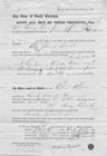
Bill of sale for mulatto man …
Five generations on Smith's P…
m
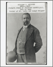
Portrait of Judge William J. …
Freed slave escorting her chi…
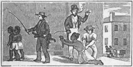
Black Mother being separated …
A black family being separated
A black woman pleading for th…
m
Map of Charleston and its vic…
m
Preliminary chart of Port Roy…
J.H. Colton's topographical m…
Map of comparison of Maffitt'…
Post route map of the States …
Beaufort River, S.C. : from B…
Preliminary chart of North Ed…
m
The city of Charleston, South…
Plan of the siege of Charlest…
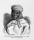
Aunt Bransom. - A venerable e…
Military map of part of Georg…
Middle Georgia & South Caroli…
Preliminary chart of Port Roy…
Preliminary chart of Calibogu…
New map of Charleston Harbor:…
Fortifications of Charleston …
Tybee Bay and Calibogue Sound…
Map of the state of South Car…
Sketch of Beaufort, Port Roya…
Military map of South Carolina
Preliminary chart of Bull's B…
Map of North Carolina and Sou…
Johnson's North Carolina and …
Preliminary survey of Winyah …
Charleston : a map showing th…
Charleston harbour, S. Ca. : …
Preliminary chart of North Ed…
A bird's-eye view of the city…
Map of the Sea-Coast of South…
Preliminary chart of Port Roy…
m
Post route map of the states …
m
Watson and Adams new topograp…
St. Helena Sound, South Carol…
Preliminary chart of Calibogu…
North Carolina & South Caroli…
Preliminary chart of the sea …
Sketch of portions of seacoas…
Sketch E showing the progress…
Plan of the old fort at Dorch…
m
Post route map of the states …
m
Post route map of the states …
Reconnaissance of Port Royal …
Preliminary chart of Winyah B…
1
2
Previous
Next
1
2
Previous
Next