Click to visit the main New York Public Library Homepage
The New York Public Library
Digital Collections
About Digital Collections
Browse
Search only public domain materials
Items
Collections
Divisions
Home
Search
Browse
About
Search only public domain materials
Items
Collections
Divisions
Digital Collections
Using Images
Using Data
Search
Filtered search
Show filters
Hide filters
Show Only Public Domain
topic
Indians of North America
63
Pueblos
11
Geological surveys
10
Indian reservations
8
Indians of North America -- Southwest, New -- 1800-1899
8
More
Less
name
Brown, William Henry (1928-)
38
Continent Stereoscopic Company
27
Wittick, Ben, 1845-1903
13
Geographical Surveys West of the 100th Meridian (U.S.)
10
Wheeler, George M. (George Montague), 1842-1905
10
More
Less
collection
Robert N. Dennis collection of stereoscopic views
147
Detroit Publishing Company postcards
38
Maps of North America
23
Wallach Division Picture Collection
17
"The Pageant of America" Collection
15
More
Less
place
x
New Mexico
Santa Fe (N.M.)
55
United States
22
Southwest, New
16
West (U.S.)
11
More
Less
genre
Photographs
187
Stereographs
147
Postcards
38
Maps
24
Prints
9
More
Less
publisher
Detroit Publishing Company
38
s.n
10
General Land Office
3
Government Printing Office
2
S. Augustus Mitchell
2
More
Less
division
Wallach Division: Photography Collection
213
Map Division
24
Wallach Division: Picture Collection
16
Milstein Division
12
type
still image
243
cartographic
24
text
1
Date Range
to
266 results found
Filtering on:
x
Date
: 1836 - 1899
x
Place
: New Mexico
Sort by:
Title
Date created
Date digitized
Sequence
Houston Post map of the great…
Barometric profile of the rou…
Map showing the lines of comm…
County and township map of Ar…
California, Utah, Lr. Califor…
Territory of New Mexico
Map showing the route pursued…
Preliminary map of the wester…
District of New Mexico
Sketch of public surveys in N…
Sectional map of Colfax and M…
Old territory and military de…
Topographical & township map …
Territory of New Mexico
Territory of New Mexico
Map of the territory of New M…
Map of the territory of New M…
Map of explorations and surve…
Sketch of public surveys in N…
County map of the state of Te…
Map of the country between th…
Map showing private land clai…
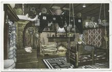
Mantel Piece, Indian Building…
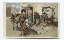
Pena Blanca Tienda (A Mexican…
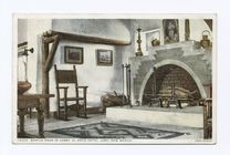
Mantle Piece in Lobby, El Ort…
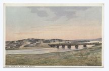
Pueblo of Zuni, New Mexico
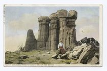
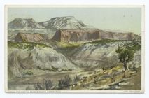
Geological Formations near Ga…
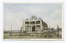
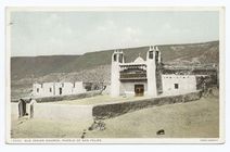
Old Church, Pueblo of Cochiti…
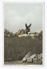
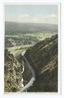
Viewing a New Mexican Landsca…
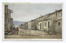
Street Scene, Pueblo of Acoma…
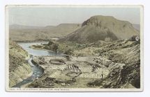
Site of Elephant Butte Dam, N…
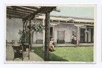
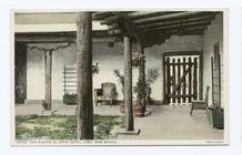
The Placita, El Ortiz Hotel, …
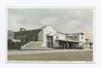
El Ortiz, New Santa Fe Hotel,…
El Ortiz, New Santa Fe Hotel,…
The Placita, El Ortiz, Hotel,…
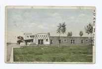
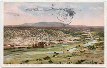
Birdseye View of, Hotel, Lamy…
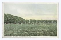
Fat Cattle and Alfalfa in the…
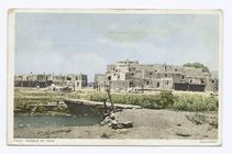
Pueblo of Taos near Santa Fe,…
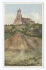
Red Buttes near Fort Wingate,…
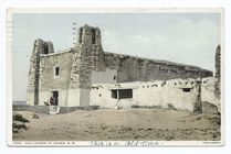
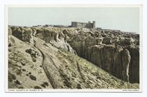
Old Church at Acoma, New Mexi…
Apache Canyon in the Gloriett…
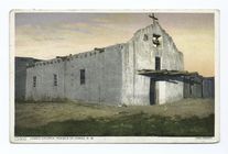
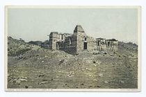
Jemez Church, Pueblo of Jemez…
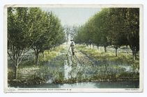
Irrigating Apple Orchard, Hag…
Old Spanish Convent, Lamy, N.…
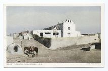
The Church of Pueblo Laguna, …
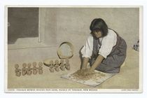
Tesuque Woman Making Rain God…
Church at Acoma, New Mexico
Navaho Church near Fort Winga…
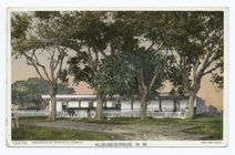
Hacienda of Perfecto Armijo, …
Old Indian Church, Pueblo San…
1
2
Previous
Next
1
2
Previous
Next