Click to visit the main New York Public Library Homepage
The New York Public Library
Digital Collections
About Digital Collections
Browse
Search only public domain materials
Items
Collections
Divisions
Home
Search
Browse
About
Search only public domain materials
Items
Collections
Divisions
Digital Collections
Using Images
Using Data
Search
Filtered search
Show filters
Hide filters
Show Only Public Domain
topic
x
Landowners
Real property
378
Administrative and political divisions
93
Real propery auctions
35
Railroads
30
More
Less
name
Bourquin, F. (Frederick), 1808-
40
Worley & Bracher
34
Warner & Foote
32
Smith, Robert Pearsall, 1827-1898
28
Walling, Henry Francis, 1825-1888
25
More
Less
collection
Maps of North America
262
Maps of New York City and State
201
Collection of broadside real estate maps announcing auctions of lots in early 19th century New York City
35
Atlases of the United States
11
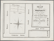
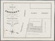
Maps of property in the city of New York belonging to John J. Astor Esq
1
place
New York (State)
242
New York
88
Manhattan (New York, N.Y.)
53
New York (N.Y.)
49
United States
42
More
Less
genre
Maps
510
Cadastral maps
328
Manuscript maps
24
Illustrations
13
Atlases
11
More
Less
publisher
publisher not identified
68
Published by Warner & Foote
25
M. Dripps
14
J.B. Beers & Co
11
Stone and Clark,
11
More
Less
division
Map Division
509
No Division
1
type
cartographic
509
still image
24
text
7
Date Range
to
510 results found
Filtering on:
x
Date
: 1836 - 1900
x
Topic
: Landowners
Sort by:
Title
Date created
Date digitized
Sequence
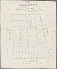
Lloyd's topographical map of …
m
Maps of property in the city …
Property in the towns of Cast…
Map of property in the 19th w…
m
Topographical map of New York…
m
New map of Kings and Queens c…
m
Map of the City of Brooklyn a…
m
Driving road chart of the cou…
Livingston Heights : Livingto…
m
Map of the southern part of W…
m
Map of Ulster County, New York
m
Map of Washington County, New…
Map of the battlefield of Fre…
Map of the Rhode Island state…
Map of Conanicut Island, oppo…
A map of the town of New-ark …
Plan of real estate at Harris…
Plan of extension of Devonshi…
Plan of extension of Devonshi…
Map of the port & vicinity of…
m
Chicago
m
To the honourable House of Re…
Map of the survey of Wissahic…
m
Map of Bates County, Missouri
m
Map of Johnson County, Missou…
m
Map of Pettis County, Missour…
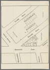
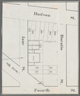
Horatio Street, Hudson Street…
Gansevoort Street, 9th Avenue…
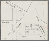
Jane Street, Eighth Avenue, T…
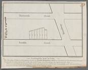
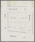
Thirteenth Street, Greenwich …
m
Hammond Street, Perry Street,…
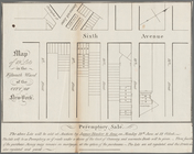
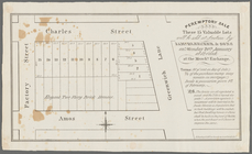
Peremptory sale these 15 valu…
Executors sale of part of the…
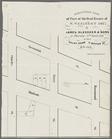
Hudson Street, Horatio Street…
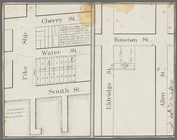
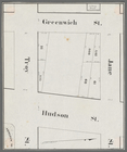
Greenwich Street, Troy Street…
m
Map of 19 lots in the fifteen…
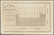
Map of property in the 9th wa…
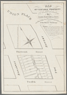
13 lots of ground to be sold …
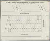
A map of property belonging t…
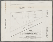
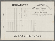
La Fayette Place map of lots …
Map of property in the eleven…
m
Map of valuable property to b…
m
Map of lots on Lafayette Plac…
m
Peremptory sale of lots, on T…
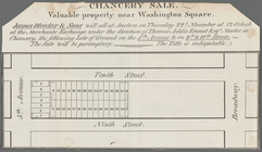
Chancery sale, valuable prope…
m
Map of a water grant between …
Map of property in the 7th Wa…
Map of property in the 4th Wa…
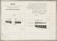
Map of property to be sold by…
Map of property in the 13th W…
1
2
3
Previous
Next
1
2
3
Previous
Next