Click to visit the main New York Public Library Homepage
The New York Public Library
Digital Collections
About Digital Collections
Browse
Search only public domain materials
Items
Collections
Divisions
Home
Search
Browse
About
Search only public domain materials
Items
Collections
Divisions
Digital Collections
Using Images
Using Data
Search
Filtered search
Show filters
Hide filters
Show Only Public Domain
topic
Cotton industry
28
History
23
New Bern, Battle of, New Bern, N.C., 1862
21
Freed persons
19
Nautical charts
18
More
Less
name
H.C. White Co
25
White Oak Cotton Mills
25
United States Coast Survey
23
Bache, A. D. (Alexander Dallas), 1806-1867
19
Littleton View Co
7
More
Less
collection
Robert N. Dennis collection of stereoscopic views
58
Maps of North America
37
Wallach Division Picture Collection
24
Brief report of the services rendered by the freed people to the United States Army in North Carolina: in the spring of 1862 after the battle of Newbern
19
"The Pageant of America" Collection
14
More
Less
place
x
North Carolina
United States
38
Greensboro
25
Greensboro (N.C.)
25
French Broad River (N.C. and Tenn.)
9
More
Less
genre
Photographs
81
Stereographs
58
Maps
37
Illustrations
21
Nautical charts
18
More
Less
publisher
H. C. White Co
25
V. Colyer
19
U.S. Coast Survey
13
U.S. Coast Survey Office
8
E. & H.T. Anthony (Firm)
7
More
Less
division
Wallach Division: Photography Collection
72
Map Division
37
Wallach Division: Picture Collection
24
Schomburg Manuscripts, Archives and Rare Books Division
23
Milstein Division
8
More
Less
type
still image
132
cartographic
37
text
4
Date Range
to
169 results found
Filtering on:
x
Date
: 1839 - 1869
x
Place
: North Carolina
Sort by:
Title
Date created
Date digitized
Sequence
Fort Fisher [N.C.]
m
Convention of the Freedmen of…
Mountain region of North Caro…
J.H. Colton's topographical m…
Middle Virginia and North Car…
Map of Virginia, part of West…
Pictorial map of the seat of …
Coast of North Carolina & Vir…
Eastern portion of the milita…
Sketch D showing the progress…
A compleat map of North-Carol…
Johnson's North Carolina and …
Reconnaissance of New River a…
Reconnaissance of Hatteras In…
Sketch D, No. 2 showing the p…
Albemarle and Chesapeake Cana…
Albemarle Sound, N. Carolina,…
Preliminary chart of Beaufort…
m
Lands in the State of North C…
Albemarle Sound, N. Carolina,…
North Carolina & South Caroli…
Sketch of the coast of North …
Preliminary chart of Frying P…
Preliminary chart of Frying P…
Coast chart no. 48, Cape Fear…
Preliminary chart of lower pa…
Atlantic Coast, Chesapeake en…
Beaufort Harbour, North Carol…
Preliminary chart of the sea …
Preliminary sketch of Beaufor…
Sketch of Frying-Pan Shoals a…
Preliminary chart of Hatteras…
Sketch of Ocracoke Inlet, Nor…
Albemarle and Chesapeake Cana…
m
Lands in the State of North C…
m
Map of the states of North Ca…
Map showing the routes traver…
Map of part of Virginia, Nort…
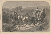
Cotton team in North Carolina
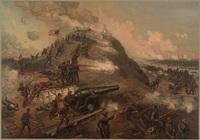
Capturing of Fort Fisher.
Coast chart from Cape Hattera…
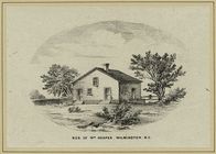
Res[idence] of Wm. Hooper, Wi…
North Carolina.
m
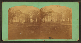
The Capitol at Raleigh, from …
m
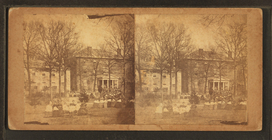
St. Mary's School, Raleigh, N…
m
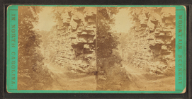
Painted rocks on the French B…
m
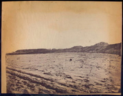
View of Broad River, Hickory …
m
View at Laurel Creek near the…
m
Lover's Leap, on the French B…
m
View on the French Broad Rive…