Click to visit the main New York Public Library Homepage
The New York Public Library
Digital Collections
About Digital Collections
Browse
Search only public domain materials
Items
Collections
Divisions
Home
Search
Browse
About
Search only public domain materials
Items
Collections
Divisions
Digital Collections
Using Images
Using Data
Search
Filtered search
Show filters
Hide filters
Show Only Public Domain
topic
Administrative and political divisions
4
Boundaries
2
Rivers
2
Boundary disputes
1
Foreign relations
1
More
Less
name
Anson, W
1
Bowdoin College
1
Breese, Samuel, 1802-1873
1
Colesworthy, Samuel Hodgson, 1808-
1
Dankworth, Frederick, approximately 1804-
1
More
Less
collection
Maps of North America
9
Atlases of the United States
1
I. N. Phelps Stokes Collection of American Historical Prints
1
place
x
Maine
Canada
4
New Brunswick
3
United States
3
Northeast boundary of the United States
2
More
Less
genre
Maps
10
Prints
1
publisher
publisher not identified
2
Engraved & published by S.H. Colesworthy
1
J. Griffin
1
J.M. Mason
1
John G. Deane?
1
More
Less
division
Map Division
10
Wallach Division: Print Collection
1
type
cartographic
10
still image
1
Date Range
to
11 results found
Filtering on:
x
Date
: 1840 - 1849
x
Place
: Maine
Sort by:
Title
Date created
Date digitized
Sequence
m
Map of Maine: constructed fro…
Map of the state of Maine: co…
m
Map of the State of Maine wit…
Map of a section of the Andro…
Map of Maine & the disputed …
Map of a section of the Cobbe…
A New map of Maine
Part of the United States, Lo…
Extract from a map of the Bri…
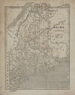
Maine.
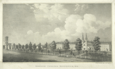
Bowdoin College Brunswick, Me.
End of results
|
Top