Click to visit the main New York Public Library Homepage
The New York Public Library
Digital Collections
About Digital Collections
Browse
Search only public domain materials
Items
Collections
Divisions
Home
Search
Browse
About
Search only public domain materials
Items
Collections
Divisions
Digital Collections
Using Images
Using Data
Search
Filtered search
Show filters
Hide filters
Show Only Public Domain
topic
Real property
5965
Fire insurance
3606
Cities & towns
3396
Administrative and political divisions
713
Railroads
610
More
Less
name
Sanborn Map Company
3396
Beers, F. W. (Frederick W.)
649
E. Robinson Co
354
Perris, William
311
Robinson, E. (Elisha)
304
More
Less
collection
Atlases of New York City
4734
Atlases of the United States
2464
Maps of North America
2325
Maps of New York City and State
1148
Atlases, gazetteers, guidebooks and other books
119
More
Less
place
New York (State)
6498
New York
1053
New York (N.Y.)
627
Manhattan (New York, N.Y.)
537
Brooklyn (New York, N.Y.)
493
More
Less
genre
Maps
10632
Atlases
2404
Cadastral maps
419
Topographic maps
210
Nautical charts
192
More
Less
publisher
Sanborn Map Company
3396
publisher not identified
316
E. Robinson Co
306
F. W. Beers & Co
148
William Perris
143
More
Less
division
x
Map Division
Wallach Division: Photography Collection
18
type
cartographic
10688
text
301
still image
140
Date Range
to
10,946 results found
Filtering on:
x
Date
: 1845 - 1896
x
Division
: Map Division
Sort by:
Title
Date created
Date digitized
Sequence
Lloyd's topographical map of …
m
Nuevo mapa topográfico de la …
Plan of the Central Park, Cit…
Saratoga Springs [Township]
Schuylerville Business Direct…
Saratoga [Township]
Stillwater [Township]
References; Waterford [Villag…
Waterford [Township]
Beechers Hollow [Village]; Be…
Wilton [Township]
Map of Saratoga County
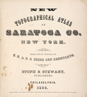
New topographical atlas of Sa…
Residence of James Carrigan, …
Index
Acres of Land, Population, Dw…
Table of Distances in Saratog…
Ballston [Township]
Ballston Spa Business Directo…
Charlton [Township]
Grangerville [Village]; Grang…
Clifton Park [Township]
Corinth [Township]; Palmer Fa…
Clifton Park [Village]; Clift…
Day Corners Business Director…
Edinburgh [Township]
Crescent [Village]; Crescent …
Galway [Township]; Yorks Corn…
Greenfield [Township]; Pages …
Bloodville [Village]; Bloodvi…
Hadley [Township]; Hadley Bus…
Half Moon [Township]
Factory Village [Village]; Fa…
Malta [Township]
Burnt Hills [Village]; Burnt …
Milton [Township]
Moreau [Township]
Conklingville [Village]; Conk…
Northumberland [Township]
Providence [Township]; Hagedo…
References; Saratoga Springs …
m
Johnson's Physical Map
Geographische Verbreitung der…
England & Wales
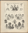
Types of the races of man
Cram's unrivaled atlas of the…
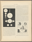
The Earth
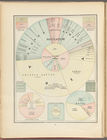
Population
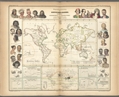
Ethnographic map of the world…
m
Mercator projection exhibitin…
1
2
3
4
5
6
7
8
9
10
…
43
44
Previous
Next
1
2
3
4
5
6
7
8
9
10
…
43
44
Previous
Next