Click to visit the main New York Public Library Homepage
The New York Public Library
Digital Collections
About Digital Collections
Browse
Search only public domain materials
Items
Collections
Divisions
Home
Search
Browse
About
Search only public domain materials
Items
Collections
Divisions
Digital Collections
Using Images
Using Data
Search
Filtered search
Show filters
Hide filters
Show Only Public Domain
topic
Railroads
7
Administrative and political divisions
3
Triangulation
3
United States
3
Wampanoag Indians
3
More
Less
name
Bache, A. D. (Alexander Dallas), 1806-1867
3
Redding & Co
3
United States Coast Survey
3
Goldthwait, J. H
2
Massasoit, 1580-1661
2
More
Less
collection
Maps of North America
11
Wallach Division Picture Collection
3
Maps of New York City and State
2
place
x
New England
Atlantic Coast (New England)
4
New York (State)
4
Massachusetts
3
Canada
2
More
Less
genre
Maps
13
Conjectural works
2
Prints
1
Tourist maps
1
publisher
U.S. Coast Survey
3
Redding & Co
2
Harper & Brothers
1
J.H. Colton
1
Nathan Hale
1
More
Less
division
Map Division
13
Wallach Division: Picture Collection
3
type
cartographic
13
still image
3
Date Range
to
16 results found
Filtering on:
x
Date
: 1847 - 1855
x
Place
: New England
Sort by:
Title
Date created
Date digitized
Sequence
Rail road map of New England,…
Colton's railroad & township …
Southern New England
Railroad map of New England &…
Telegraph and rail road map o…
Sketch A, showing the primary…
Sketch A, shewing the progres…
Sketch A, shewing the progres…
A map of the New England stat…
Lloyd's map of the Canadas, N…
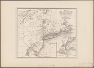
Map of New Netherland: accord…
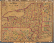
Mitchell's county and townshi…
m
The north eastern coast of No…
Meeting of Governor Carver an…
Great mortality among the Ind…
Philip's war
End of results
|
Top