Click to visit the main New York Public Library Homepage
The New York Public Library
Digital Collections
About Digital Collections
Browse
Search only public domain materials
Items
Collections
Divisions
Home
Search
Browse
About
Search only public domain materials
Items
Collections
Divisions
Digital Collections
Using Images
Using Data
Search
Filtered search
Show filters
Hide filters
Show Only Public Domain
topic
Parks
1353
Real property
506
Buildings, structures, etc
389
Historic buildings
389
Streets
256
More
Less
name
Sperr, Percy Loomis, 1890-1964
1844
E. & H.T. Anthony (Firm)
494
Wurts Bros. (New York, N.Y.)
392
Perris, William
258
Bromley, George Washington
232
More
Less
collection
Photographic views of New York City, 1870's-1970's, from the collections of the New York Public Library
4757
Robert N. Dennis collection of stereoscopic views
2280
Atlases of New York City
513
Collection of photographs of New York City
389
Maps of New York City and State
222
More
Less
place
x
Manhattan (New York, N.Y.)
New York (N.Y.)
7672
New York (State)
3818
New York
3499
Central Park (New York, N.Y.)
1096
More
Less
genre
Photographs
7426
Stereographs
2280
Maps
724
Index maps
20
Manuscript maps
20
More
Less
publisher
G.W. Bromley & Co
232
Perris & Browne
124
William Perris
105
E. & H.T. Anthony (Firm)
33
E. Robinson Co
24
More
Less
division
Milstein Division
5147
Wallach Division: Photography Collection
2244
Map Division
734
Wallach Division: Print Collection
10
Wallach Division: Picture Collection
2
More
Less
type
still image
7440
cartographic
730
text
26
Date Range
to
8,177 results found
Filtering on:
x
Date
: 1848 - 1899
x
Place
: Manhattan (New York, N.Y.)
Sort by:
Title
Date created
Date digitized
Sequence
New-York City, County, and vi…
Sketch map of the city of New…
New map of the great metropol…
Map of the Harlem River and S…
m
Manhattan borough and part of…
m
Taunton new guide map and dir…
m
Sanitary & topographical map …
m
Topographical map of New York…
Map of the 23rd and 24th ward…
City guide
Map of New York City : showin…
Map of the borough of Manhatt…
Dutch traders at Manhattan
m
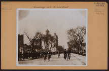
Manhattan: Broadway - 61st St…
m
Manhattan: 69th Street (West)…
m
Manhattan: 67th Street - West…
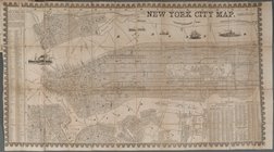
New York City Map
m
Fr. Brooklyn Bridge.
m
Manhattan: 36th Street (East)…
m
Manhattan: 36th Street (East)…
m
Manhattan: 5th Avenue - 40th …
m
Manhattan: Broadway - 47th St…
m
Manhattan: 54th Street (West)…
m
Manhattan: 14th Street (West)…
m
Manhattan: 14th Street (West)…
m
Manhattan: 36th Street (East)…
m
Manhattan: 5th Avenue - 40th …
m
Manhattan: 5th Avenue - [Betw…
m
Manhattan: 11th Street (West)…
m
Manhattan: 12th Avenue - 48th…
m
Manhattan: 5th Avenue - 42nd …
m
Manhattan: MacDougal Street -…
m
Manhattan: Grove Street - Was…
m
Manhattan: Houston Street (Ea…
m
Manhattan: Grove Street - Bed…
m
Manhattan: Milligan Place - H…
m
Manhattan: William Street - J…
m
Manhattan: Patchin Place - 10…
m
Manhattan: Wall Street - Nass…
m
Manhattan: Patchin Place - 10…
m
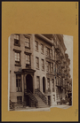
Manhattan: St. Lukes Place - …
m
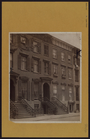
Manhattan: St. Lukes Place - …
m
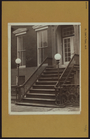
Manhattan: St. Lukes Place - …
m
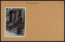
Manhattan: St. Lukes Place - …
m
Manhattan: St. Lukes Place - …
m
Manhattan: St. Lukes Place - …
m
Manhattan: Bedford Street - M…
m
Manhattan: Commerce Street - …
Map of New York City and of M…
A topographical map of the no…
1
2
3
4
5
6
7
8
9
10
…
32
33
Previous
Next
1
2
3
4
5
6
7
8
9
10
…
32
33
Previous
Next