Click to visit the main New York Public Library Homepage
The New York Public Library
Digital Collections
About Digital Collections
Browse
Search only public domain materials
Items
Collections
Divisions
Home
Search
Browse
About
Search only public domain materials
Items
Collections
Divisions
Digital Collections
Using Images
Using Data
Search
Filtered search
Show filters
Hide filters
Show Only Public Domain
topic
Real property
17
Administrative and political divisions
11
Landowners
10
Railroads
6
Geology
5
More
Less
name
Battelle, W
11
Pease, Richard H., 1813-1869
8
Ackerman Lithr
5
Sherman & Smith
5
Atwood, John M., approximately 1818-
4
More
Less
collection
Maps of North America
61
Maps of New York City and State
48
Robert N. Dennis collection of stereoscopic views
18
Maps of the Oceans
2
Atlases, gazetteers, guidebooks and other books
1
More
Less
place
New York (State)
30
Massachusetts
24
Taunton (Mass.)
19
New York (N.Y.)
18
New York
10
More
Less
genre
Maps
114
Photographs
18
Stereographs
18
Cadastral maps
10
Geological maps
4
More
Less
publisher
publisher not identified
25
s.n
5
J.& F. Tallis
2
J.H. Colton
2
M. Dripps
2
More
Less
division
x
Map Division
Wallach Division: Photography Collection
18
type
cartographic
112
still image
21
Date Range
to
132 results found
Filtering on:
x
Date
: 1850 - 1850
x
Division
: Map Division
Sort by:
Title
Date created
Date digitized
Sequence
Ethnographic map of the world…
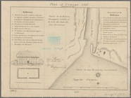
Plan of the town of Brooklyn …
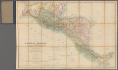
Map of Central America includ…
Map of the Great Salt Lake an…
Map of the frontiers of the n…
Geological map of the distric…
To the citizens of Philadelph…
Diagram of the state of Misso…
Section and diagram illustrat…
Map of the northern peninsula…
Map of the tertiary of Essex …
Geological map of the Lake Su…
A sketch of the public survey…
A new map of the state of Ohio
Geological reconnaissances in…
Sketch of the route of Capt. …
Map of the city of San Franci…
Map of the states of Missouri…
Map of lands belonging to Jam…
Map of the "Hunter Fly Farm" …
A map of Maryland and Virgini…
Map of Indiana
Indiana, 1820
City of Covington
Plan of the old fort at Dorch…
Reconnoissance of Cape Canave…
Reconnoissance [sic] of St. A…
The boundary lines between th…
Cat and Ship Island harbors :…
City of New Haven
Rail road map of New England,…
A plan of the Manor of Philip…
Southern New England
Plan of Oswego, 1727: (from P…
Map of the village of Taunton…
Plan of Public Garden: showin…
Map of property on the highla…
Plan of Boston and its vicini…
A plan of the action at Bunke…
Plan of house lots in South F…
Map of a reconnoissance betwe…
The harbor of New Bedford
Lake George, Fort Ticonderoga…
m
Map of Geneva, Ontario Co., N…
Plan of the city of Albany ab…
Map of Massachusetts
Map of part of Fairfield Coun…
Fort la Présentation anno 174…
Map of Seneca County, New Yor…
Topographical map of Seneca C…
Filter
x
Sorry. Nothing matches your entry
Feedback
Close
Feedback
Thank you!
Comment
Correction
Bug
400
Take a survey
Send
Please wait...
Thank you for helping the Library.
Close