Click to visit the main New York Public Library Homepage
The New York Public Library
Digital Collections
About Digital Collections
Browse
Search only public domain materials
Items
Collections
Divisions
Home
Search
Browse
About
Search only public domain materials
Items
Collections
Divisions
Digital Collections
Using Images
Using Data
Search
Filtered search
Show filters
Hide filters
Show Only Public Domain
topic
x
Administrative and political divisions
Railroads
15
Landowners
9
Real property
9
Canals
7
More
Less
name
Colton, J. H. (Joseph Hutchins), 1800-1893
5
Smith, Robert Pearsall, 1827-1898
4
Atwood, John M., approximately 1818-
3
Friend & Aub
3
Magnus, Charles
3
More
Less
collection
Maps of New York City and State
27
Maps of North America
26
place
New York (State)
27
New York (N.Y.)
9
Brooklyn (New York, N.Y.)
7
Connecticut
7
New York
7
More
Less
genre
Maps
53
Cadastral maps
6
Diagrams
1
Prints
1
Surveys
1
More
Less
publisher
publisher not identified
6
J.H. Colton
5
Surveyor General's Office
3
Charles Magnus
2
Ensign, Thayer & Co
2
More
Less
division
Map Division
53
type
cartographic
52
still image
1
Date Range
to
53 results found
Filtering on:
x
Date
: 1850 - 1854
x
Topic
: Administrative and political divisions
Sort by:
Title
Date created
Date digitized
Sequence
Plan of the city of Philadelp…
The city of Chicago, Cook Co.…
m
Norman's plan of New Orleans …
Plan of the city of Philadelp…
A plat exhibiting the state o…
A new map of the state of Ohio
Reduced map of the state of C…
Map of the surveyed portions …
m
Map of Loudoun County, Virgin…
Map of the states of Missouri…
m
Colton's map of the state of …
Map of the city of Chicago
Indiana, 1820
New sectional map of the stat…
A map of a tract of land in t…
A plat exhibiting the state o…
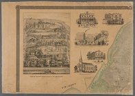
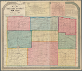
Colton's railroad & township …
Southern New England
Topographical map of New York…
Map of the village of Taunton…
Map of the town of Tiverton, …
Plan of Boston comprising a p…
Map of Orleans County, New Yo…
The state of Connecticut: inc…
m
Map of the vicinity of Albany…
Connecticut: with portions of…
m
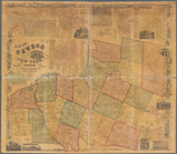
Map of Oswego, Oswego Co., N.…
m
Map of New London County, Con…
Map of Massachusetts
Connecticut
Map of Oswego County, New Yor…
m
Map of Rockland County, New Y…
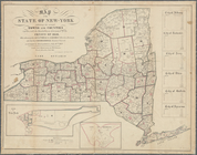
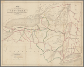
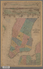
Map of the State of New-York …
Map of the Sacketts Harbor an…
Map showing the position of t…
Mitchell's county and townshi…
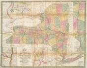
Map of the state of New York …
Map of the State of New-York:…
Colton's railroad & township …
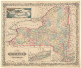
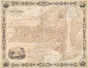
Map of the State of New York
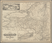
Map of the State of New York
m
Map of the state of New-York:…
Plan von New-York, 1851
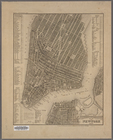
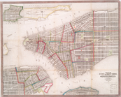
Map of the City of New York w…
Map of the city of New York :…
Map of the state of New York …
Map of the state of New York …
Map of the state of New York
Map of the state of New York …
m
Map of Staten Island, or Rich…