Click to visit the main New York Public Library Homepage
The New York Public Library
Digital Collections
About Digital Collections
Browse
Search only public domain materials
Items
Collections
Divisions
Home
Search
Browse
About
Search only public domain materials
Items
Collections
Divisions
Digital Collections
Using Images
Using Data
Search
Filtered search
Show filters
Hide filters
Show Only Public Domain
topic
Interiors
25
Streets
21
Churches
19
Administrative and political divisions
18
Capitols
17
More
Less
name
Prescott & White
22
Kellogg, E. P. (Edwin P.)
21
Bundy, J. K. (Joseph K.), 1812-
20
Folsom, A. H. (Augustine H.), -1926
15
Willimantic Linen Co
15
More
Less
collection
Robert N. Dennis collection of stereoscopic views
205
Maps of North America
23
Maps of New York City and State
20
"The Pageant of America" Collection
15
Photographic views of the United States
15
More
Less
place
x
Connecticut
New Haven (Conn.)
57
Hartford (Conn.)
49
New Haven County (Conn.)
22
New York (State)
21
More
Less
genre
Photographs
235
Stereographs
205
Maps
43
Prints
8
Cadastral maps
7
More
Less
publisher
publisher not identified
10
The Commissioners
5
E. & H.T. Anthony (Firm)
4
New York State Board of Railroad Commissioners?
3
U.S. Coast Survey office
3
More
Less
division
Wallach Division: Photography Collection
220
Map Division
43
Milstein Division
15
Wallach Division: Print Collection
8
Wallach Division: Picture Collection
3
type
still image
246
cartographic
43
Date Range
to
289 results found
Filtering on:
x
Date
: 1850 - 1871
x
Place
: Connecticut
Sort by:
Title
Date created
Date digitized
Sequence
m
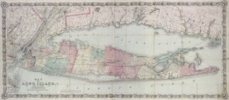
Map of Long Island and the so…
Map of the state of New York:…
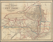
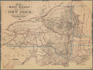
Map of the rail-roads of the …
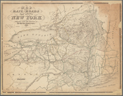
Map of the rail roads of the …
Map showing the New York and …
m
Eastern part of Long Island S…
Long Island Sound (western sh…
Middle part of Long Island So…
Plan of the New Haven City bu…
Johnson's Vermont, New Hampsh…
Colton's railroad & township …
Southern New England
Johnson's Massachusetts, Conn…
Massachusetts, Connecticut an…
m
Map of Tolland County, Connec…
m
Map of northern parts of the …
The state of Connecticut: inc…
m
Clark's map of Fairfield Coun…
Harbor of New London and the…
Hartford in 1640
Connecticut: with portions of…
m
Map of New London County, Con…
Plan of Danbury, Fairfield Co…
Map of the New-Haven water su…
The principal parts of Norwal…
Town of Ridgefield, Fairfield…
The principal parts of Norwal…
Connecticut
Town of Bethel, Fairfield Co.…
Harbors of Captain's Island E…
m
Map of the rail-roads of the …
Engineers map of the state of…
Map of the rail roads of the …
Map of the boundary between t…
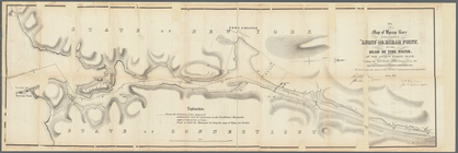
Diagram showing the relative …
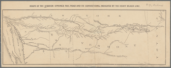
Route of the Lebanon Springs …
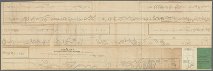
Diagrams of the New-York and …
m
Diagrams of the New-York and …
Map of Byram River from its m…
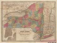
Map of the state of New York …
Map of the rail-roads of the …
Map of the rail-roads of the …
Evening, Cape Ann; Low Tide, …
m
Map of Long Island and the so…
Yale University, New Haven, C…
Yale College and State House,…
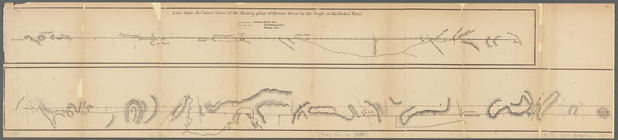
View of the landing-place of …
Saybrook.
m
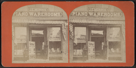
J.E. Morris Piano warerooms, …
m
The residence of Morris Ketch…
1
2
Previous
Next
1
2
Previous
Next