Click to visit the main New York Public Library Homepage
The New York Public Library
Digital Collections
About Digital Collections
Browse
Search only public domain materials
Items
Collections
Divisions
Home
Search
Browse
About
Search only public domain materials
Items
Collections
Divisions
Digital Collections
Using Images
Using Data
Search
Filtered search
Show filters
Hide filters
Show Only Public Domain
topic
Real property
60
Railroads
9
Administrative and political divisions
7
Landowners
6
Ferries
2
More
Less
name
Beers, F. W. (Frederick W.)
55
Prindle, A. B
54
Atwood, John M., approximately 1818-
6
Colton, G. Woolworth (George Woolworth), 1827-1901
6
Dripps, M. (Matthew)
6
More
Less
collection
Atlases of New York City
54
Maps of New York City and State
21
Maps of North America
10
place
x
New York Metropolitan Area
Westchester County (N.Y.)
56
New York (State)
20
New Jersey
14
New York
14
More
Less
genre
Maps
80
Cadastral maps
4
Illustrations
3
Topographic maps
3
Manuscript maps
1
More
Less
publisher
F. W. Beers, A. D. Ellis & others
54
G.W. & C.B. Colton & Co
4
J.H. Colton
4
M. Dripps
3
J.H. Higginson
2
More
Less
division
Map Division
85
type
cartographic
79
still image
3
text
3
Date Range
to
85 results found
Filtering on:
x
Date
: 1850 - 1871
x
Place
: New York Metropolitan Area
Sort by:
Title
Date created
Date digitized
Sequence
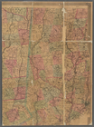
New-York City, County, and vi…
Map of the country thirty thr…
Map of the country thirty thr…
Map of New York and vicinity …
Map of the country thirty thr…
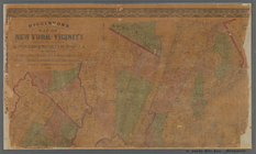
New-York and vicinity as prop…
New York City and environs : …
Map of the country thirty-thr…
Map of the country thirty-thr…
Map of the country thirty-thr…
m
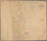
Map of the City of New York a…
Map of the port & vicinity of…
Map of New Netherland with a …
m
Auction sale at Montrose Stat…
m
Topographical map of the stat…
m
Map of the city of Newark, N.…
Map of property of the Ruther…
Topographical map of New York…
Topographical map of the stat…
Map showing lines filed by Ne…
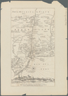
The state of Connecticut: inc…
Connecticut: with portions of…
m
12,000 Square Miles around Ne…
m
Higginson's map of New York a…
m
Map of the five cities of New…
Map of the cities of New York…
New York and vicinity
New-York city and county map …
New-York City, County and vic…
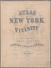
Atlas of New York and vicinit…
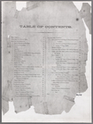
Table of Contents
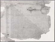
Table of Air-line Distances
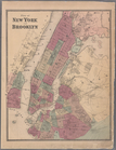
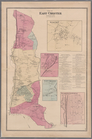
Plate 5: Map of New York and …
Plate 6: Plan of New York and…
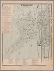
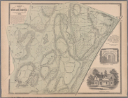
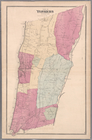
Plate 9: Tremont : Town of We…
Plate 11: Fordham
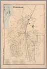
Plate 13: West Farms, Westche…
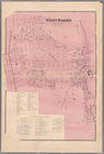
Plate 15: Wakefield : Town & …
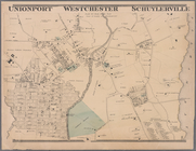
Plate 16: Unionport - Westche…
Plate 17: Map of the Woodlawn…
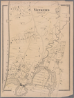
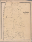
Plate 19: Town of Yonkers, We…
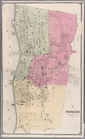
Plate 20: Yonkers, Westcheste…
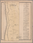
Plate 21: Town of Yonkers, We…
Plate 23: Yonkers, Westcheste…
Plate 24: Northern part of To…
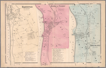
Plate 26: Hastings upon Hudso…
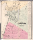
Plate 28: Plan of Tarrytown a…
Plate 30: Town of Greenburgh,…
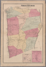
Plate 32: Town of East Cheste…
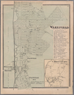
Plate 34: Mount Vernon, Westc…