Click to visit the main New York Public Library Homepage
The New York Public Library
Digital Collections
About Digital Collections
Browse
Search only public domain materials
Items
Collections
Divisions
Home
Search
Browse
About
Search only public domain materials
Items
Collections
Divisions
Digital Collections
Using Images
Using Data
Search
Filtered search
Show filters
Hide filters
Show Only Public Domain
topic
Insurance, Fire
38
Maps
38
Real property
8
Buildings
7
Administrative and political divisions
6
More
Less
name
Perris, William
40
Dripps, M. (Matthew)
4
Bornet, John
3
Atwood, John M., approximately 1818-
2
Eno, Amos F., 1836-1915
2
More
Less
collection
Atlases of New York City
38
Maps of New York City and State
23
Wallach Division Picture Collection
6
I. N. Phelps Stokes Collection of American Historical Prints
2
Scrapbooks of New York City views
2
More
Less
place
x
Brooklyn (New York, N.Y.)
New York (State)
23
New York
20
New York (N.Y.)
12
Manhattan (New York, N.Y.)
4
More
Less
genre
Maps
61
Cadastral maps
3
Prints
3
Views
3
Clippings
2
More
Less
publisher
William Perris
38
s.n
4
M. Dripps
3
Ensign, Thayer & Co
2
Thomas W. Field
2
More
Less
division
Map Division
61
Wallach Division: Picture Collection
5
Wallach Division: Print Collection
4
Milstein Division
2
type
cartographic
61
still image
12
text
2
Date Range
to
73 results found
Filtering on:
x
Date
: 1851 - 1856
x
Place
: Brooklyn (New York, N.Y.)
Sort by:
Title
Date created
Date digitized
Sequence
m
Map of the city of Brooklyn, …
m
Topographical map of New York…
m
Map of the City of Brooklyn a…
m
Topographical map of the city…
m
Peremptory sale of a suburban…
m
Plan of property situate in t…
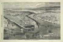
Battle of Long Island: from S…
m
Map of Kings and part of Quee…
m
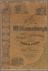
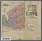
Map of the city of Williamsbu…
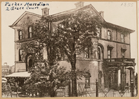
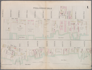
Packer Mansion, 2 Grace Court
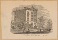
Graham Institute
Topographical map of New York…
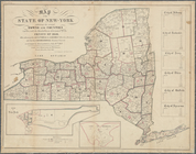
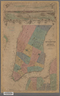
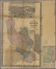
Map of the State of New-York …
Plan von New-York, 1851
Map of the City of New York w…
m
Plan of the city of Brooklyn,…
m
Plan of the city of Brooklyn,…
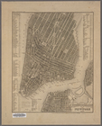
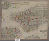
The city of New York
m
Plan of property situate in t…
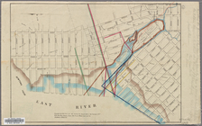
Map showing a part of Brookly…
m
Map of the City of Williamsbu…
Map of the City of Williamsbu…
Map of the Cities of Brooklyn…
m
Map of the City of New York w…
Map of the City of New York w…
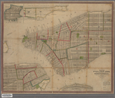
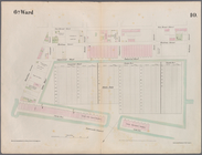
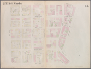
Plate 1: Map bounded by North…
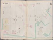
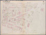
Plate 2: Map bounded by South…
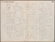
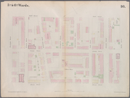
Plate 3: Map bounded by East …
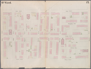
Plate 4: Map bounded by East …
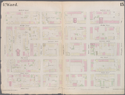
Plate 5: Map bounded by East …
Plate 6: Map bounded by Popla…
Plate 7: Map bounded by Pierr…
Plate 8: Map bounded by Pacif…
Plate 9: Map bounded by Butte…
Plate 10: Map bounded by Hami…
Plate 11: Map bounded by But…
Plate 12: Map bounded by York…
Plate 13: Map bounded by Conc…
Plate 14: Map bounded by Mark…
Plate 15: Map bounded by Pine…
Plate 16: Map bounded by Mont…
Plate 17: Map bounded by Atla…
Plate 18: Map bounded by Degr…
Plate 19: Map bounded by Conc…
Plate 20: Map bounded by Flus…
Plate 21: Map bounded by Flus…
Plate 22: Map bounded by Myrt…
Plate 23: Map bounded by Lafa…
Plate 24: Map bounded by Myrt…
Plate 25: Map bounded by Will…