Click to visit the main New York Public Library Homepage
The New York Public Library
Digital Collections
About Digital Collections
Browse
Search only public domain materials
Items
Collections
Divisions
Home
Search
Browse
About
Search only public domain materials
Items
Collections
Divisions
Digital Collections
Using Images
Using Data
Search
Filtered search
Show filters
Hide filters
Show Only Public Domain
topic
Geology
9
Coal mines and mining
4
Railroads
4
Coal
3
Anthracite coal mines and mining
2
More
Less
name
Hart, Lane S
4
Ashburner, Charles A. (Charles Albert), 1854-1889
3
Geological Survey of Pennsylvania
3
Lesley, J. P. (J. Peter), 1819-1903
3
Sheafer, A. W. (Arthur Whitcomb), 1856-1943
3
More
Less
collection
Maps of North America
16
Atlases, gazetteers, guidebooks and other books
1
Coreografie per ballabili d'opera
1
Spalding baseball collection
1
The A. G. Spalding Baseball Collection
1
More
Less
place
Pennsylvania
5
Michigan
4
United States
3
Carbon County
2
Carbon County (Pa.)
2
More
Less
genre
x
Diagrams
Maps
16
Geological cross-sections
8
Charts
5
Illustrations
3
More
Less
publisher
Geological Survey of Pennsylvania
2
Benjamin Smith Lyman?
1
Board of Commissioners for the Second Geological Survey
1
Board of Railroad Commissioners
1
E. Thunot et Cie
1
More
Less
division
Map Division
17
Manuscripts and Archives Division
3
Billy Rose Theatre Division
1
General Research Division
1
Jerome Robbins Dance Division
1
More
Less
type
cartographic
16
still image
10
text
7
Date Range
to
24 results found
Filtering on:
x
Date
: 1852 - 1885
x
Genre
: Diagrams
Sort by:
Title
Date created
Date digitized
Sequence
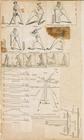
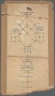
Diagram of a cricket field: s…
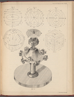
Professor Maxwell on a dynami…
Diagram illustrating the work…
m
Coreografie per ballabili d'o…
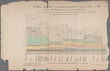
Tableau figuratif du mouvemen…
Magneto-geological chart of R…
Map of Township 51, North, R…
Geological map of Rockland an…
m
Profile of grades of the Iowa…
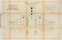
Route of the Peninsula Railro…
Map of the mines of the Panth…
A geological and topographica…
Map and profile of the Tejon …
Map and profile of the Cañada…
Topographical map of the coal…
Second Geological Survey of P…
m
Map and geological cross-sect…
No. 1, diagram of coal measur…
m
Title map of the coal field o…
A series of columnar sections…
The American origin of baseba…
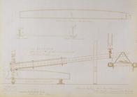
Lever for testing iron beams,…
Profiles of the canals and ra…
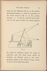
The ghost illusion, figure 10…
End of results
|
Top