Click to visit the main New York Public Library Homepage
The New York Public Library
Digital Collections
About Digital Collections
Browse
Search only public domain materials
Items
Collections
Divisions
Home
Search
Browse
About
Search only public domain materials
Items
Collections
Divisions
Digital Collections
Using Images
Using Data
Search
Filtered search
Show filters
Hide filters
Show Only Public Domain
topic
Real property
245
Historic buildings
58
Railroads
47
Insurance, Fire
38
Maps
38
More
Less
name
G.M. Hopkins & Co
108
E. Robinson Co
77
Robinson, E. (Elisha)
77
Perris, William
52
Pidgeon, R. H. (Roger H.)
43
More
Less
collection
Atlases of New York City
317
Maps of New York City and State
125
Photographic views of New York City, 1870's-1970's, from the collections of the New York Public Library
59
Wallach Division Picture Collection
49
Collection of photographs taken by Daniel B. Austin and his associate, Adam Dove, depicting buildings, street scenes and Brooklyn and Long Island views, particularly Flatbush, Gravesend and New Utrecht, and generally for the period 1885-1914
39
More
Less
place
x
Brooklyn (New York, N.Y.)
New York (State)
516
New York
491
New York (N.Y.)
187
To 1899
35
More
Less
genre
Maps
427
Photographs
180
Prints
28
Views
22
Stereographs
19
More
Less
publisher
G.M. Hopkins & Co
108
E. Robinson Co
77
William Perris
38
G. W. Bromley & E. Robinson
37
Higginson, J. H
21
More
Less
division
Map Division
441
Milstein Division
169
Wallach Division: Picture Collection
40
Wallach Division: Photography Collection
24
Wallach Division: Print Collection
19
More
Less
type
cartographic
429
still image
265
text
23
Date Range
to
706 results found
Filtering on:
x
Date
: 1854 - 1890
x
Place
: Brooklyn (New York, N.Y.)
Sort by:
Title
Date created
Date digitized
Sequence
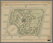
Prospect Park
m
Brooklyn: Devoe Street - Lori…
Map of New York, Brooklyn, an…
New map of the great metropol…
m
Taunton new guide map and dir…
m
Topographical map of New York…
Design for laying out the gro…
m
New map of Kings and Queens c…
New map of Brooklyn and vicin…
m
Map of the city of Brooklyn
Map of the county of Kings, s…
Watson's new map of the city …
Map of the city of Brooklyn
m
Map of the consolidated City …
m
Map of the City of Brooklyn a…
m
Topographical map of the city…
m
Peremptory sale of a suburban…
Plan of the town of Brooklyn …
Colton's New York City, Brook…
m
Watson's new map of New York …
m
Watson's new map of New York …
m
Watson's new map of New York,…
m
Brooklyn: Court Street - Fult…
m
Brooklyn: Court Street - Jora…
m
Brooklyn: Court Street - Myrt…
m
Brooklyn: Clarendon Road - 22…
m
Brooklyn: Bedford Avenue - Di…
m
Brooklyn: Bath Avenue - Bay 1…
m
Brooklyn: Atlantic Avenue - W…
m
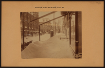
Brooklyn: Clark Street - Fult…
m
Chapel Street in New Haven, C…
The street-car strike in Broo…
m
Brooklyn: 6th Avenue - Sterli…
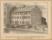
Kirk's Printing Office, birth…
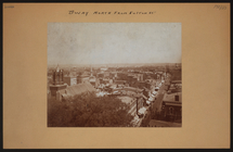
General views, Nostrand Ave.
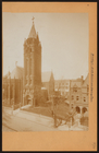
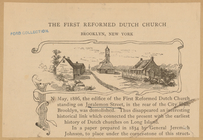
The First Reformed Dutch Chur…
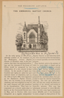
The Emmanuel Baptist Church
m
New map of Kings and Queens c…
Plan of the Battle of Long Is…
Battle of Long Island: from S…
Map of Brooklyn at the time o…
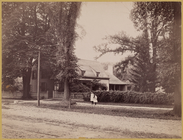
Three Mile House (1854)
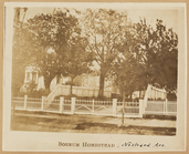
Boerum Homestead
Benson Homestead, Bensonhurst
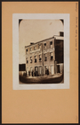
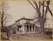
Victorian house
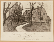
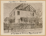
Martense House
Dutch style farm house with t…
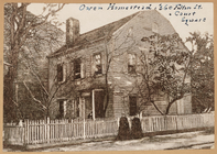
Owen Homestead
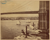
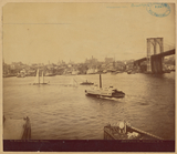
View of Manhattan from Brookl…
View of Manhattan from Brookl…
1
2
3
Previous
Next
1
2
3
Previous
Next