Click to visit the main New York Public Library Homepage
The New York Public Library
Digital Collections
About Digital Collections
Browse
Search only public domain materials
Items
Collections
Divisions
Home
Search
Browse
About
Search only public domain materials
Items
Collections
Divisions
Digital Collections
Using Images
Using Data
Search
Filtered search
Show filters
Hide filters
Show Only Public Domain
topic
Real property
358
History
139
Landowners
128
Administrative and political divisions
109
Nautical charts
106
More
Less
name
Perris, William
204
Perris & Browne
141
United States Coast Survey
135
Bache, A. D. (Alexander Dallas), 1806-1867
111
Beers, S. N
54
More
Less
collection
Maps of North America
584
Atlases of New York City
265
Maps of New York City and State
208
Atlases of the United States
89
Atlases, gazetteers, guidebooks and other books
53
More
Less
place
New York (State)
427
New York
230
Manhattan (New York, N.Y.)
177
United States
134
Virginia
98
More
Less
genre
x
Maps
Cadastral maps
107
Nautical charts
94
Atlases
89
Bathymetric maps
56
More
Less
publisher
Perris & Browne
124
publisher not identified
80
U.S. Coast Survey
63
S. A. Mitchell, jr
50
U.S. Coast Survey Office
44
More
Less
division
Map Division
1201
General Research Division
14
Schomburg Manuscripts, Archives and Rare Books Division
6
Manuscripts and Archives Division
4
Schomburg Jean Blackwell Hutson Research and Reference Division
4
More
Less
type
cartographic
1232
still image
33
text
18
Date Range
to
1,239 results found
Filtering on:
x
Date
: 1855 - 1865
x
Genre
: Maps
Sort by:
Title
Date created
Date digitized
Sequence
m
Nuevo mapa topográfico de la …
Plan of the Central Park, Cit…
Map of Camp Chase. Drawn on a…
Map illustrating the operatio…
Das freie und das Sklaverei-G…
m
Mercator projection exhibitin…
New-York City, County, and vi…
New-York and vicinity as prop…
New York City and environs : …
Map of the country thirty-thr…
Map of the country thirty-thr…
m
Sanitary & topographical map …
Map of property in the 19th w…
Map of the city of Brooklyn
m
Map of the consolidated City …
m
Map of the City of Brooklyn a…
m
Topographical map of the city…
m
Peremptory sale of a suburban…
Plan of the town of Brooklyn …
Flushing
m
Plan of the Land in Haverhill…
m
Reynolds' map of modern Londo…
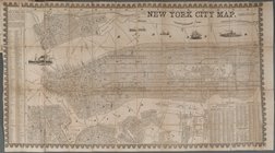
New York City Map
Plan d'ensemble de la cité ou…
Plan d'ensemble de la cité ou…
Colton's railroad & township …
Map of the rail-roads of the …
Survey of St. Mary's Church L…
Region of Bone-Boiling and Sw…
Map of Wisconsin designed to …
Johnson's Georgetown and the …
Portion of the Military depar…
Colton's Georgetown and the c…
Plan of Public Garden: showin…
Map of the water region: adja…
Skeleton map of the overland …
Map showing route of marches …
Plan of extension of Devonshi…
Plan of extension of Devonshi…
Plan of South Bay: showing ch…
Plan for the occupation of th…
Map of free states, slave sta…
Geognosticheskaia karta bereg…
Karta rasprostraneniia dreves…
Plan chasti goroda Aiguna
Plan Albazinskago ukrepleniia…
Map of the port & vicinity of…
Chengwatana, Pine County, M.T…
Map of the territory of Minne…
m
Chicago
1
2
3
4
5
Previous
Next
1
2
3
4
5
Previous
Next