Click to visit the main New York Public Library Homepage
The New York Public Library
Digital Collections
About Digital Collections
Browse
Search only public domain materials
Items
Collections
Divisions
Home
Search
Browse
About
Search only public domain materials
Items
Collections
Divisions
Digital Collections
Using Images
Using Data
Search
Filtered search
Show filters
Hide filters
Show Only Public Domain
topic
Nautical charts
18
Landowners
12
Administrative and political divisions
11
Real property
10
Railroads
7
More
Less
name
United States Coast Survey
17
Bache, A. D. (Alexander Dallas), 1806-1867
16
Mathiot, G
6
Smith, M. L. (Martin Luther), 1819-1866
6
Seib, J. (John)
5
More
Less
collection
Maps of North America
44
Maps of New York City and State
18
Denkmaeler aus Aegypten und Aethiopien nach den Zeichnungen der von seiner Majestat dem Koenige von Preussen Friedrich Wilhelm IV nach diesen Landern gesendeten und in den Jahren 1842-1845 ausgefuhrten wissenschaftlichen Expedition ..
3
Lawrence H. Slaughter Collection of English maps, charts, globes, books and atlases
1
Maps of the Arctic Regions
1
place
New York (State)
15
Virginia
6
Florida
5
California
4
Minnesota
4
More
Less
genre
x
Maps
Nautical charts
15
Bathymetric maps
11
Cadastral maps
9
Prints
3
More
Less
publisher
U.S. Coast Survey
9
U.S. Coast Survey Office
6
Nicolaische Buchhandlung
3
publisher not identified
3
Charles Desilver
2
More
Less
division
Map Division
64
General Research Division
3
type
cartographic
67
still image
5
Date Range
to
67 results found
Filtering on:
x
Date
: 1856 - 1856
x
Genre
: Maps
Sort by:
Title
Date created
Date digitized
Sequence
m
Mercator projection exhibitin…
Map of the southern part of M…
Sketch of the public surveys …
Kentucky
m
Map of Clinton Co., New York:…
New map of Minnesota : carefu…
m
Chapman's new sectional map o…
Map of Minnesota
Sketch of the public surveys …
Chapman's sectional map of Wi…
Map of the city of Richmond, …
Galveston entrance, Texas
Superior, Douglass County, Wi…
m
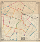
Map of Allegany Co., N.Y.: fr…
Geological plan & section fro…
Geological map of the Tejon P…
Preliminary chart of North Ed…
Map of the U.S.
Reconnaissance of Olympia Har…
Rappahannock River, Virginia …
Geological plan of the Coast …
Preliminary chart of San Pabl…
m
Map of Trumbull County, Ohio
Reconnaissance of the S.E. en…
Rappahannock River, Virginia …
Preliminary chart of Rappahan…
Preliminary chart of Rappahan…
Map of the Clinton County Coa…
A new map of the state of Cal…
Preliminary chart of Waccasas…
Map showing the location of t…
Preliminary chart of the sea …
Preliminary chart of lower pa…
Preliminary chart of the sea …
Preliminary chart of St. John…
Preliminary chart of St. Mark…
Preliminary chart of St. John…
Map of Bennington County, Ver…
Map of the State of Florida :…
m
A new map of Arkansas with it…
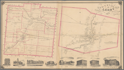
Town & Village of Leroy, Gene…
Town & village of Seneca Fall…
m
Colton's railroad & township …
Map of part of Virginia, Nort…
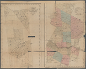
Map of the county of Herkimer
m
Map of the village & town of …
Sketch J showing the progress…
m
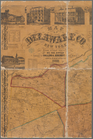
Map of Delaware Co., New York
Plan of Groton Cemetery
Map of Sullivan County, New Y…