Click to visit the main New York Public Library Homepage
The New York Public Library
Digital Collections
About Digital Collections
Browse
Search only public domain materials
Items
Collections
Divisions
Home
Search
Browse
About
Search only public domain materials
Items
Collections
Divisions
Digital Collections
Using Images
Using Data
Search
Filtered search
Show filters
Hide filters
Show Only Public Domain
topic
x
Administrative and political divisions
Railroads
83
Landowners
36
Real property
30
Canals
17
More
Less
name
G.W. & C.B. Colton & Co
22
Johnson, A. J. (Alvin Jewett), 1827-1884
21
United States. General Land Office
13
Bien, Julius, 1826-1909
11
Sampson, Davenport & Co
11
More
Less
collection
Maps of North America
165
Maps of New York City and State
105
place
New York (State)
91
New York (N.Y.)
36
Manhattan (New York, N.Y.)
33
Massachusetts
31
Brooklyn (New York, N.Y.)
27
More
Less
genre
Maps
270
Cadastral maps
18
Aerial views
2
Illustrations
2
Tourist maps
2
More
Less
publisher
publisher not identified
19
A.J. Johnson
13
G.W. & C.B. Colton & Co
12
Sampson, Davenport & Co
11
J.H. Colton
5
More
Less
division
Map Division
269
Manuscripts and Archives Division
1
type
cartographic
270
still image
4
text
1
Date Range
to
270 results found
Filtering on:
x
Date
: 1860 - 1878
x
Topic
: Administrative and political divisions
Sort by:
Title
Date created
Date digitized
Sequence
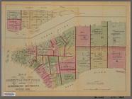
Map of New York, Brooklyn, an…
Map showing location of lands…
Map of the County of New York…
Map of the county of Kings, s…
Watson's new map of the city …
Map of the city of Brooklyn
Map of the state of New York:…
Map of the rail-roads of the …
Map of the rail roads of the …
Plan of the city of Philadelp…
Map of Boston for 1878: Publi…
New and improved map of the c…
McClung's map of Minnesota : …
m
Chicago
Map of Chicago and its wester…
State of Indiana
Johnson's Indiana
Hunt's map of Philadelphia : …
m
Colton's new sectional map of…
m
Map of the city of St. Louis,…
Railroad map of Michigan
Johnson's Wisconsin and Michi…
m
Post route map of the states …
Johnson's Minnesota
Rice & Reed's township map of…
Rice's township & rail road m…
Johnson's Minnesota
Map of the compact portion of…
Map of Rochester, Olmsted Co.…
State of Michigan
Map of Philadelphia photograp…
State of Illinois
Map of Lafayette Co.: [Wiscon…
m
Map of Monroe County, Wiscons…
Blanchard's map of Wisconsin …
State of Wisconsin
Map of the state of Texas [an…
Map of the state of Missouri …
Johnson's Nebraska, Dakota, I…
New map of Missouri
m
Map of the vicinity of Philad…
New and improved map of the c…
Richardson's new map of the s…
The only correct map of the c…
Map of the state of Florida :…
Johnson's Vermont and New Ham…
Richardsons new map of the st…
Township map of Kansas : comp…
Blanchard's Guide map of Kans…
Johnson's Kansas and Nebraska
1
2
Previous
Next
1
2
Previous
Next