Click to visit the main New York Public Library Homepage
The New York Public Library
Digital Collections
About Digital Collections
Browse
Search only public domain materials
Items
Collections
Divisions
Home
Search
Browse
About
Search only public domain materials
Items
Collections
Divisions
Digital Collections
Using Images
Using Data
Search
Filtered search
Show filters
Hide filters
Show Only Public Domain
topic
x
Railroads
Administrative and political divisions
210
Surveying
81
Explorers
79
Roads
59
More
Less
name
Stanton, Robert Brewster, 1846-1922
79
Rand McNally and Company
72
Portland & Ogdensburg Railroad Company
42
Fotografiia Engelia
38
Zakaspīĭskai͡a zheli͡eznai͡a doroga
38
More
Less
collection
Maps of North America
355
Maps of New York City and State
246
Robert N. Dennis collection of stereoscopic views
97
Robert Brewster Stanton papers
79
Zakaspīĭskaia voennaia zhelieznaia doroga
38
More
Less
place
New York (State)
272
United States
150
New York
144
New York (N.Y.)
96
Arizona
90
More
Less
genre
Maps
616
Photographs
297
Stereographs
97
Charts
37
Pamphlets
37
More
Less
publisher
publisher not identified
40
Fotografiia Engelia
38
G.W. & C.B. Colton & Co
31
Detroit Publishing Company
30
Rand, McNally & Co
25
More
Less
division
Map Division
600
Wallach Division: Photography Collection
220
Manuscripts and Archives Division
91
General Research Division
55
Wallach Division: Picture Collection
15
More
Less
type
cartographic
612
still image
384
text
64
notated music
8
Date Range
to
1,034 results found
Filtering on:
x
Date
: 1860 - 1913
x
Topic
: Railroads
Sort by:
Title
Date created
Date digitized
Sequence
m
Poi͡asnitelʹnai͡a zapiska kʺ …
m
Proektʺ Karakovskoĭ zheli͡ezn…
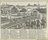
Pesnia. 'Bliz Krasnykh Vorot …
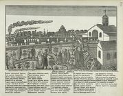
Zheleznaia doroga.
Lloyd's topographical map of …
Map of the borough of Brookly…
m
Map of the borough of Brookly…
The Cord Meyer Development Co…
Rand, McNally & Co.'s new aut…
Brooklyn
m
Rand, McNally & Co.'s complet…
Railroads in Manhattan, Jerse…
Railroad suburbs between Holl…
Erie Railroad suburban lines
Rand McNally standard map of …
Greater New York and Long Isl…
Map of Hudson & Manhattan Rai…
Rapid transit map of Kings, Q…
m
Map of the borough of Queens,…
Map of Hudson & Manhattan Rai…
Rand, McNally & Co.'s new han…
Greater New York City
m
Eagle Almanac map of the boro…
m
New York und Umgegend
Map of New York City region a…
Map of the City of New York :…
Freight terminal map of New Y…
Center of New York, first cit…
Map of the City of New York a…
Map of the country thirty thr…
Sketch map of the City of New…
Map of the Hackensack & New Y…
Map showing the present dista…
Map of the country thirty thr…
Map showing location of lands…
Map of the country thirty thr…
Map of the country thirty thr…
Map of New York and vicinity …
Map of the country thirty thr…
m
Manhattan borough and part of…
m
Rand-McNally standard map of …
Map of boroughs of Manhattan …
m
Authentic street plan of grea…
m
Hammond's new guide map of Ma…
The Matthews-Northrup up-to-d…
m
Taunton new guide map and dir…
m
Map of the city of Brooklyn
Mapa de la ciudad de Nueva Yo…
m
Robinson's map of New York Ci…
Proposed site on Staten Islan…
1
2
3
4
5
Previous
Next
1
2
3
4
5
Previous
Next