Click to visit the main New York Public Library Homepage
The New York Public Library
Digital Collections
About Digital Collections
Browse
Search only public domain materials
Items
Collections
Divisions
Home
Search
Browse
About
Search only public domain materials
Items
Collections
Divisions
Digital Collections
Using Images
Using Data
Search
Filtered search
Show filters
Hide filters
Show Only Public Domain
topic
x
Roads
Railroads
40
Mountains
37
Administrative and political divisions
30
Passes (Landforms)
19
More
Less
name
Kilburn Brothers
31
Pease, N. W. (Nathan W.), 1836-1918
17
G.W. & C.B. Colton & Co
11
L. Prang & Co
10
Johnson, A. J. (Alvin Jewett), 1827-1884
7
More
Less
collection
Robert N. Dennis collection of stereoscopic views
98
Maps of North America
44
Maps of New York City and State
27
Publisher's proofs of the publications of L. Prang & Co., and scrapbooks of colored advertising cards, published by L. Prang & Co. and other firms
9
Views of Japan
5
More
Less
place
New Hampshire
65
White Mountains (N.H. and Me.)
37
New York (State)
35
Crawford Notch (N.H.)
29
United States
14
More
Less
genre
Photographs
122
Stereographs
98
Maps
71
Road maps
18
Proofs
8
More
Less
publisher
G.W. & C.B. Colton & Co
10
L. Prang & Co
9
publisher not identified
6
A.J. Johnson
4
D. Appleton
4
More
Less
division
Wallach Division: Photography Collection
118
Map Division
71
Wallach Division: Print Collection
10
Dorot Jewish Division
5
Wallach Division: Picture Collection
5
More
Less
type
still image
143
cartographic
71
text
4
Date Range
to
213 results found
Filtering on:
x
Date
: 1863 - 1892
x
Topic
: Roads
Sort by:
Title
Date created
Date digitized
Sequence
View of Chambersburg Turnpike…
Map of the City of New York a…
m
Driving road chart of the cou…
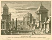
Via Appia, near Rome
McClung's map of Minnesota : …
Johnson's Minnesota
Johnson's Vermont and New Ham…
Map showing the boulevards an…
Portion of the copper distric…
Map of the lakes & drives aro…
A new map of the states of Ca…
m
Colton's new map of Long Isla…
Johnson's Oregon and Washingt…
Yellowstone National Park
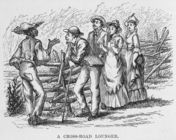
A cross-road lounger.
District of New Mexico
Topographical & township map …
Department of Arizona, Sheet …
Map of the City of Baltimore:…
Johnson's Illinois
Railway and highway map of th…
Historical map of Nantucket
Johnson's Missouri and Kansas
Military map of part of Georg…
Map of the state of South Car…
Military map of South Carolina
Johnson's North Carolina and …
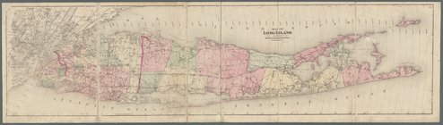
Map of Long Island
Road map of Erie County and p…
The army map of Georgia
Van Loan's road map of the Ca…
Topographical map of the stat…
Map of Newport, R.I.
Rand, McNally & Co.'s Vermont
Map of Washington and vicinity
New York to New Rochelle: fro…
Road map of 'he sea coast of …
Rand, McNally & Co.'s Rhode I…
Driving and bicycle map of Es…
Driving road chart of Monmout…
State of Rhode Island
Colton's road map of Monmouth…
m
Driving and cycling chart of …
Railway and highway map of th…
Johnson's Arkansas, Mississip…
Map showing the Lehigh Valley…
Road map of Northern New Jers…
Map of the Dead River, Kenneb…
Map of Steuben County: to acc…
Map of Rockland Co: [New York]