Click to visit the main New York Public Library Homepage
The New York Public Library
Digital Collections
About Digital Collections
Browse
Search only public domain materials
Items
Collections
Divisions
Home
Search
Browse
About
Search only public domain materials
Items
Collections
Divisions
Digital Collections
Using Images
Using Data
Search
Filtered search
Show filters
Hide filters
Show Only Public Domain
topic
x
Administrative and political divisions
Railroads
33
Landowners
18
Real property
12
Canals
8
More
Less
name
G.W. & C.B. Colton & Co
15
Johnson, A. J. (Alvin Jewett), 1827-1884
10
Dripps, M. (Matthew)
7
Walling, Henry Francis, 1825-1888
5
Watson, Gaylord
5
More
Less
collection
Maps of North America
68
Maps of New York City and State
55
place
New York (State)
46
Brooklyn (New York, N.Y.)
18
Manhattan (New York, N.Y.)
17
New York (N.Y.)
17
Massachusetts
16
More
Less
genre
Maps
123
Cadastral maps
6
Aerial views
1
Nautical charts
1
Topographic maps
1
More
Less
publisher
publisher not identified
9
A.J. Johnson
8
G.W. & C.B. Colton & Co
7
M. Dripps
4
Gaylord Watson
3
More
Less
division
Map Division
122
Manuscripts and Archives Division
1
type
cartographic
123
still image
1
Date Range
to
123 results found
Filtering on:
x
Date
: 1865 - 1872
x
Topic
: Administrative and political divisions
Sort by:
Title
Date created
Date digitized
Sequence
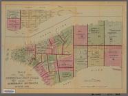
Map of the County of New York…
Map of the county of Kings, s…
Watson's new map of the city …
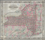
Map of the state of New York:…
Map of the rail-roads of the …
Map of the rail roads of the …
McClung's map of Minnesota : …
m
Colton's new sectional map of…
m
Map of the city of St. Louis,…
Johnson's Minnesota
Rice & Reed's township map of…
Rice's township & rail road m…
Johnson's Minnesota
Map of Philadelphia photograp…
Map of Lafayette Co.: [Wiscon…
Blanchard's map of Wisconsin …
Map of the state of Missouri …
Johnson's Nebraska, Dakota, I…
New map of Missouri
New and improved map of the c…
Richardson's new map of the s…
Johnson's Vermont and New Ham…
Township map of Kansas : comp…
Johnson's Kansas and Nebraska
A new map of the states of Ca…
Half of an unidentified map s…
Colton's railroad & township …
Oregon
m
Map of the city and suburbs o…
Karte von Californien und The…
m
A new map of Indiana : exhibi…
Colton's sectional map of the…
Fragment of a map, covering p…
Hampshire and Hampden countie…
Franklin County
Map of the state of Missouri
Johnson's Missouri and Kansas
Map of the city of St. Louis …
Railroad map of Iowa
Colton's township map of the …
Township and railway map of t…
m
Hardee's geographical, histor…
City of Chicago
Map of Indiana
Map of Cook and DuPage Counti…
m
Blanchard's map of Cook and D…
Map of the Oil District of We…
Colton's new topographical ma…
Map of Long Island: showing t…
County and railroad map of th…