Click to visit the main New York Public Library Homepage
The New York Public Library
Digital Collections
About Digital Collections
Browse
Search only public domain materials
Items
Collections
Divisions
Home
Search
Browse
About
Search only public domain materials
Items
Collections
Divisions
Digital Collections
Using Images
Using Data
Search
Filtered search
Show filters
Hide filters
Show Only Public Domain
topic
Geological surveys
80
Canyons
53
Rock formations
20
Railroads construction & maintenance
11
Railroads
9
More
Less
name
Russell, Andrew J
59
Union Pacific Railroad Company
59
Bell, William, 1830-1910
56
Geographical Surveys West of the 100th Meridian (U.S.)
30
United States. War Department
30
More
Less
collection
The great West illustrated in a series of photographic views across the continent taken along the line of the Union Pacific Railroad west from Omaha, Nebraska
59
Report upon United States Geographical surveys west of the one hundredth meridian, in charge of First Lieut. Geo. M. Wheeler...U.S. Army. Atlas
50
Photographs of geological formations and Western landscapes
30
Maps of North America
10
Wallach Division Picture Collection
5
place
x
West (U.S.)
United States
82
Arizona
45
Utah
27
Grand Canyon (Ariz.)
23
More
Less
genre
Photographs
139
Maps
10
Prints
3
Conjectural works
1
Ornithological illustrations
1
publisher
Govt. Print. Off
50
War Dept
30
Corps of Engineers, War Department
2
W.J. Keeler
2
publisher not identified
2
More
Less
division
Wallach Division: Photography Collection
139
Map Division
10
Wallach Division: Picture Collection
5
type
still image
144
cartographic
10
text
1
Date Range
to
154 results found
Filtering on:
x
Date
: 1867 - 1872
x
Place
: West (U.S.)
Sort by:
Title
Date created
Date digitized
Sequence
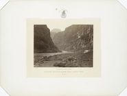
Colorado, mouth of Kanab Wash…
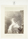
Grand Cañon, near the Paria, …
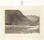
Grand Cañon, looking below mo…
Guide map of the best and sho…
m
Territory of the United State…
Map of the territory of the […
Mail and passenger route from…
m
National map of the territory…
m
National map of the territory…
Johnson's California, also Ut…
m
National map of the territory…
Map of the territory of the U…
Territory of the United State…
Annotated table of contents.P…
Annotated table of contents.P…
Annotated table of contents.P…
Annotated table of contents.P…
Back of title page
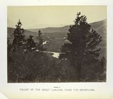
Valley of the Great Laramie, …
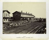
Laramie Hotel, Laramie City.
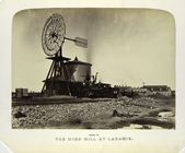
The wind mill at Laramie.
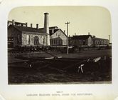
Laramie machine shops, from t…
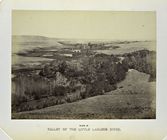
Valley of the Little Laramie …
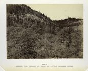
Among the timber at head of L…
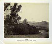
Source of the Laramie River.
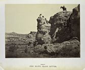
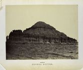
High Bluff, Black Buttes.
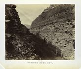
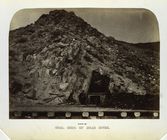
Burning Rock Cut.
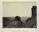
On the mountains of Green Riv…
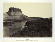
Castle Rock, Green River Vall…
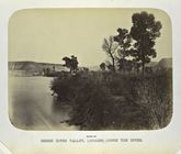
Green River Valley, looking d…
Church Buttes.
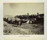
Supply trains.
Coal beds of Bear River
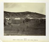
Bear River City, near the coa…
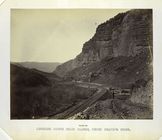
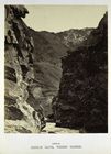
Looking down Echo Cañon, from…
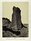
Monument Rock, mouth of Echo …
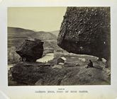
Hanging Rock, foot of Echo Ca…
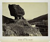
Sphynx of the valley.
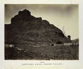
Sentinel Rock, Weber Valley.
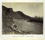
Echo City, looking up Weber R…
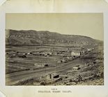
Coalville, Weber Valley.
Willhelmina Pass, from the ea…
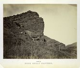
Rock Great Eastern.
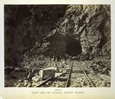
East end of tunnel, Weber Cañ…
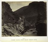
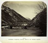
Devil's Gate, Weber Cañon.
Weber Cañon, from below Devil…
Mormon Turnpike Bridge, mouth…
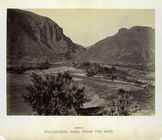
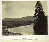
Weber Valley, from Willhelmin…
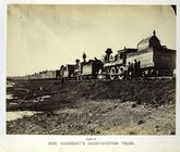
Gen. Casement's construction …
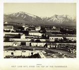
Salt Lake City, from the top …