Click to visit the main New York Public Library Homepage
The New York Public Library
Digital Collections
About Digital Collections
Browse
Search only public domain materials
Items
Collections
Divisions
Home
Search
Browse
About
Search only public domain materials
Items
Collections
Divisions
Digital Collections
Using Images
Using Data
Search
Filtered search
Show filters
Hide filters
Show Only Public Domain
topic
Real property
1376
Business enterprises
368
Administrative and political divisions
254
Railroads
213
Description and travel
157
More
Less
name
Beers, F. W. (Frederick W.)
590
Everts, Ensign & Everts
231
G.M. Hopkins & Co
175
J.B. Beers & Co
169
D.G. Beers & Co
162
More
Less
collection
Atlases of the United States
1581
Maps of North America
634
Atlases of New York City
520
Maps of New York City and State
324
Atlases, gazetteers, guidebooks and other books
26
More
Less
place
New York (State)
1568
New York
278
Brooklyn (New York, N.Y.)
253
Erie County
148
Erie County (N.Y.)
148
More
Less
genre
Maps
2899
Atlases
1541
Cadastral maps
127
Prints
67
Title pages
31
More
Less
publisher
F. W. Beers & Co
148
Beers, Comstock & Cline
114
G.M. Hopkins & Co
108
publisher not identified
103
Everts, Ensign & Everts
99
More
Less
division
x
Map Division
type
cartographic
2959
text
157
still image
29
Date Range
to
3,094 results found
Filtering on:
x
Date
: 1867 - 1880
x
Division
: Map Division
Sort by:
Title
Date created
Date digitized
Sequence
Map of the Hackensack & New Y…
Map of New York, Brooklyn, an…
m
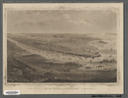
The surroundings of New York …
Map showing the present dista…
Map of the country thirty thr…
Map showing location of lands…
Map of the country thirty thr…
Map of the country thirty thr…
Map of New York and vicinity …
Map of the country thirty thr…
Map of New York City, south o…
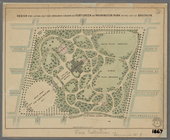
Design for laying out the gro…
New map of Brooklyn and vicin…
m
Map of the city of Brooklyn
Map of the county of Kings, s…
Watson's new map of the city …
New York and environs : desig…
m
Bridgman's map of the suburbs…
Colton's New York City, Brook…
New York and environs : desig…
m
Watson's new map of New York …
m
Map of the City of New York a…
m
Watson's new map of New York,…
Ethnological Chart of the Wor…
m
Topographical map of central …
Zeichenerklärung
m
Map of Long Island and the so…
Map of the state of New York:…
Map of the rail roads of the …
Map of the rail roads of the …
Map shewing the location of t…
Plan of the city of Philadelp…
Map of the battlefield of Fre…
Map of Conanicut Island, oppo…
Water shed of the Passaic Riv…
Progress map of the state of …
Topographical map of that por…
Back Bay and Parker Hill park…
Plan of burnt district (by fi…
Plan of real estate at Harris…
Plan of main ship channel in …
No. III, changes in the bed o…
Plan showing the redoubt, bre…
Map of Boston for 1878: Publi…
Plan of land on West Chester …
Map of Boston and the country…
Map of New England, with adja…
Map showing the New York and …
Map of Massachusetts, Vermont…
The northern route from Bosto…
1
2
3
4
5
6
7
8
9
10
…
12
13
Previous
Next
1
2
3
4
5
6
7
8
9
10
…
12
13
Previous
Next