Click to visit the main New York Public Library Homepage
The New York Public Library
Digital Collections
About Digital Collections
Browse
Search only public domain materials
Items
Collections
Divisions
Home
Search
Browse
About
Search only public domain materials
Items
Collections
Divisions
Digital Collections
Using Images
Using Data
Search
Filtered search
Show filters
Hide filters
Show Only Public Domain
topic
x
Mines and mineral resources
Railroads
34
Geology
20
Explorers
16
Surveying
16
More
Less
name
Stanton, Robert Brewster, 1846-1922
16
United States. General Land Office
6
Julius Bien & Co
5
Bien, Julius, 1826-1909
4
Cox, E. T. (Edward Travers), 1821-1907
4
More
Less
collection
Maps of North America
64
Robert Brewster Stanton papers
16
"The Pageant of America" Collection
7
Maps of New York City and State
4
Detroit Publishing Company postcards
1
More
Less
place
United States
28
Arizona
19
Idaho
18
Washington (State)
17
Colorado River (Colo.-Mexico)
16
More
Less
genre
Maps
69
Photographs
25
Geological maps
20
Manuscript maps
5
Cadastral maps
3
More
Less
publisher
publisher not identified
6
General Land Office
4
Department of the Interior, General Land Office
3
Geological Survey of Indiana
3
Publisher not identified
3
More
Less
division
Map Division
69
Manuscripts and Archives Division
16
Wallach Division: Photography Collection
9
type
cartographic
69
still image
29
text
2
Date Range
to
94 results found
Filtering on:
x
Date
: 1867 - 1977
x
Topic
: Mines and mineral resources
Sort by:
Title
Date created
Date digitized
Sequence
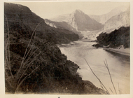
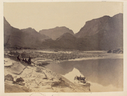
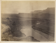
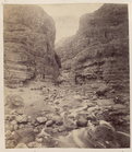
Riverbed with driftwood in fo…
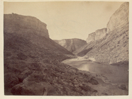
Canyon and river with boats, …
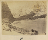
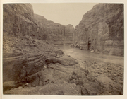
Canyon with men and boats, 647
Canyon with three boats on th…
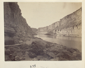
Winding river in canyon, 288
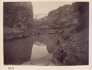
Canyon with reflection in riv…
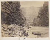
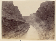
Canyon with river, 600
Canyon with two men, 606
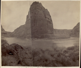
Grand Canyon, 627
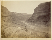
18 miles above Diamond Creek,…
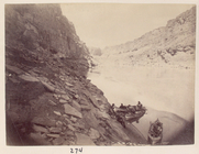
Head of Marble Canyon, 270
Canyon with rocks and water, …
River through canyon with roc…
In the Grand Canyon: Stanton …
Tunnel site in Glen Canyon, B…
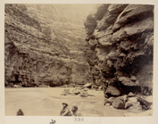
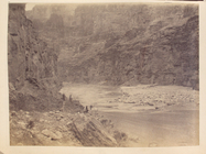
Canyon with one man, 609
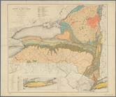
Economic and geologic map of …
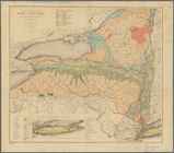
Economic and geologic map of …
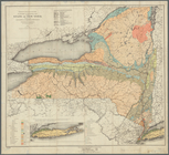
Economic and geologic map of …
Map of part of Marquette Coun…
m
Post route map of the states …
Geological map of the Lower P…
Map of a portion of Point Ke…
Mineral company lands : shade…
Map of the Iron Cliffs Co.'s …
Eagle Harbor Copper Co, and E…
m
Gold Ridge, Randolph Co., Ala…
Map of the state of Missouri …
Map showing lands of the Iron…
Map showing iron mines in vic…
Map of the iron mines of Lake…
Map of the Cripple Creek Mini…
Mines of the Kansas Ridge, Mo…
Colorado (Dolores County), Ri…
The mining investor's map of …
Map of the iron & silver regi…
Plan of the village of Marque…
Map of Dearborn, Ohio, and Sw…
Map of Pike and Dubois Counti…
Preliminary map to a geologic…
Rand, McNally & Co.'s new geo…
Summit Valley Mining District…
m
Rand, McNally & Co.'s new bus…
Outline map of Washoe Distric…
The North End Mines : field …
Topographical map showing the…
Map of the Lower Comstock and…
Territory of Arizona
Map of the Oregon Railroad an…
Map of Rockingham County, Vir…