Click to visit the main New York Public Library Homepage
The New York Public Library
Digital Collections
About Digital Collections
Browse
Search only public domain materials
Items
Collections
Divisions
Home
Search
Browse
About
Search only public domain materials
Items
Collections
Divisions
Digital Collections
Using Images
Using Data
Search
Filtered search
Show filters
Hide filters
Show Only Public Domain
topic
Real property
146
Business enterprises
26
name
Beers, F. W. (Frederick W.)
122
Asher & Adams
60
J.B. Beers & Co
45
Nichols, Beach
32
Stranahan, H. B
32
More
Less
collection
Atlases of the United States
278
place
New York (State)
206
Westchester County
45
Westchester County (N.Y.)
45
Otsego County
43
Otsego County (N.Y.)
43
More
Less
genre
x
Atlases
Maps
267
Prints
4
Title pages
2
publisher
Beers, Ellis & Soule
49
Stranahan & Nichols
32
Published by F. W. Beers, A. D. Ellis & G. G. Soule
30
Bevan, John
6
division
Map Division
278
type
cartographic
271
text
7
Date Range
to
278 results found
Filtering on:
x
Date
: 1868 - 1872
x
Genre
: Atlases
Sort by:
Title
Date created
Date digitized
Sequence
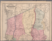
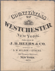
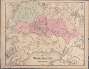
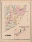
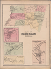
County atlas of Westchester, …
m
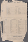
Table of Contents: Towns - Vi…
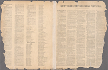
New York City Business Notice…
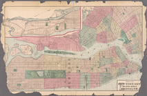
Plates 11 & 12: Map of New Yo…
m
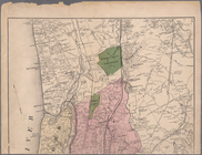
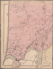
Plates 14 & 15: Towns of West…
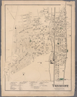
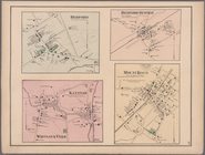
Plate 16: Tremont, Town of We…
m
Plates 17 & 18: Fordham, Town…
m
Plates 19 & 20: West Farms, W…
m
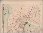
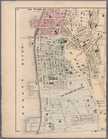
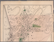
Plates 21 & 22: Town and City…
m
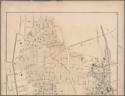
Plates 23 & 24: Southern Part…
Plate 25: Parts of 1st Ward o…
m
Plates 26 & 27: Portions of 1…
m
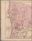
Plates 28 & 29: Portions of 2…
m
Plates 30 & 31: Mount Vernon,…
m
Plates 34 & 35: Dobbs Ferry, …
m
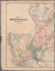
Plates 40 & 41: Town of Mount…
m
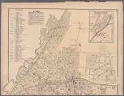
Plates 42 & 43: Tarrytown Hei…
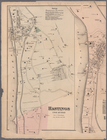
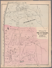
Plate 44: Town of Ossining, W…
m
Plates 45 & 46: Singsing, Tow…
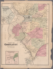
Plate 47: Town of Cortlandt, …
m
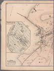
Plates 48 & 49: Plan of Peeks…
Plate 50: Town of Westchester…
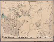
Plate 51: Westchester, Unionp…
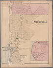
Plate 52: Wakefield, Town & C…
m
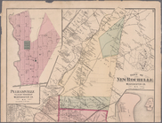
Plates 53 & 54: Town of New R…
m
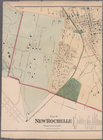
Plate 55 & 56: Part of New Ro…
m
Plates 57 & 58: Part of New R…
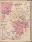
Plate 59: Town of Mamaroneck,…
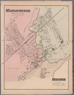
Plate 60: Mamaroneck, Westche…
m
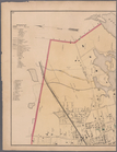
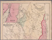
Plates 61 & 62: Town of Harri…
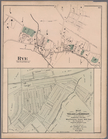
Plate 66: Rye, Town of Westch…
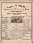
Plate 67: Park Institute, Rye…
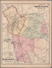
Plate 68: Town of White Plain…
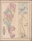
Plate 72: Town of North Castl…
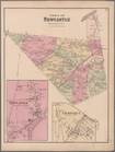
Plate 73: Town of Newcastle, …
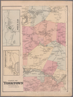
Plate 74: Town of Yorktown, W…
Plate 75: Town of Somers, Wes…
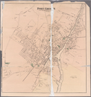
Plate 65: Port Chester, Town …
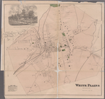
Plate 71: White Plains, Westc…
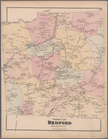
Plate 76: Town of Bedford, We…
Plate 77: Bedford. - Bedford …
Plate 78: Town of Poundridge,…
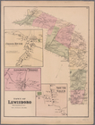
Plate 79: Town of Lewisboro, …
Plate 80: Town of North Salem…
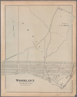
Plate 81: Woodlawn, Westchest…
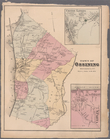
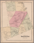
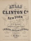
Atlas of Clinton Co., New Yor…
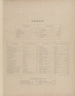
Index.
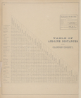
Table of Airline Distances fo…
Sketch of the Early History o…
Sketch of the Early History o…
1
2
Previous
Next
1
2
Previous
Next