Click to visit the main New York Public Library Homepage
The New York Public Library
Digital Collections
About Digital Collections
Browse
Search only public domain materials
Items
Collections
Divisions
Home
Search
Browse
About
Search only public domain materials
Items
Collections
Divisions
Digital Collections
Using Images
Using Data
Search
Filtered search
Show filters
Hide filters
Show Only Public Domain
topic
Real property
240
Administrative and political divisions
83
Railroads
67
Landowners
52
Fire insurance
21
More
Less
name
Beers, F. W. (Frederick W.)
165
Asher & Adams
63
J.B. Beers & Co
51
Prindle, A. B
49
G.M. Hopkins & Co
31
More
Less
collection
Atlases of the United States
298
Maps of North America
205
Maps of New York City and State
128
Atlases of New York City
125
Pamiatniki stariny v zapadnykh guberniakh imperii
9
More
Less
place
New York (State)
323
Westchester County (N.Y.)
98
New York Metropolitan Area
58
Brooklyn (New York, N.Y.)
55
New York (N.Y.)
48
More
Less
genre
x
Maps
Atlases
267
Cadastral maps
46
Manuscript maps
16
Prints
15
More
Less
publisher
F. W. Beers, A. D. Ellis & others
49
publisher not identified
45
Beers, Ellis & Soule
42
G.M. Hopkins
31
Published by F. W. Beers, A. D. Ellis & G. G. Soule
30
More
Less
division
Map Division
756
Rare Book Division
14
General Research Division
8
Schomburg Jean Blackwell Hutson Research and Reference Division
5
Milstein Division
1
More
Less
type
cartographic
781
text
17
still image
13
Date Range
to
785 results found
Filtering on:
x
Date
: 1868 - 1872
x
Genre
: Maps
Sort by:
Title
Date created
Date digitized
Sequence
The Jeannette ; Lost In the I…
Map of the country thirty thr…
Map of the country thirty thr…
Map of New York and vicinity …
m
Map of the city of Brooklyn
Map of the county of Kings, s…
Watson's new map of the city …
New York and environs : desig…
m
Bridgman's map of the suburbs…
New York and environs : desig…
m
Map of the City of New York a…
m
Watson's new map of New York,…
Plan Borodinskago srazheniia,…
m
Map of Long Island and the so…
Map of the rail roads of the …
Map of the rail roads of the …
Map shewing the location of t…
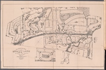
The Suburban Town of Ridley P…
Siege of Fort Meigs
Detroit River and vicinity
Plan of the Tippecanoe camp a…
Plan of the Battle of Fallen …
Battle of the Thames
Topographical map of that por…
Plan of main ship channel in …
No. III, changes in the bed o…
Map showing the New York and …
No. I, changes in the bed of …
Map of Boston and vicinity: e…
McClung's map of Minnesota : …
Map of a part of the Village …
Topographical map of Fairmoun…
Revised design for the improv…
New and enlarged map of Balti…
Map of Chicago : showing the …
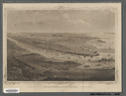
Bird's eye view of Philadelph…
m
To the honourable House of Re…
Map of the survey of Wissahic…
Map of part of Marquette Coun…
m
Colton's new sectional map of…
m
Map of the city of St. Louis,…
Township no. 20 North, Range …
Plan of the French and Americ…
Map of New Orleans and Jeffer…
Map of central Keweenaw Penin…
Magneto-geological chart of R…
Johnson's Minnesota
Mineral company lands : shade…
Rice & Reed's township map of…
Rice's township & rail road m…
1
2
3
4
Previous
Next
1
2
3
4
Previous
Next