Click to visit the main New York Public Library Homepage
The New York Public Library
Digital Collections
About Digital Collections
Browse
Search only public domain materials
Items
Collections
Divisions
Home
Search
Browse
About
Search only public domain materials
Items
Collections
Divisions
Digital Collections
Using Images
Using Data
Search
Filtered search
Show filters
Hide filters
Show Only Public Domain
topic
x
Nautical charts
Coasts
4
Harbors
4
Navigation
2
Administrative and political divisions
1
More
Less
name
United States Coast Survey
8
Bache, A. D. (Alexander Dallas), 1806-1867
3
Mathiot, G
3
Alden, James, 1810-1877
2
Boutelle, C. O. (Charles Otis)
2
More
Less
collection
Maps of North America
13
Maps of New York City and State
1
place
Massachusetts
6
Atlantic Coast
2
Atlantic Coast (Mass.)
2
California
2
Cape Cod (Mass.)
2
More
Less
genre
Maps
14
Nautical charts
13
Bathymetric maps
6
Facsimiles
1
coastal charts
1
publisher
U.S. Coast Survey
4
United States Coast Survey
3
publisher not identified
2
Geo. Coolidge
1
Pease lith
1
More
Less
division
Map Division
14
type
cartographic
14
Date Range
to
14 results found
Filtering on:
x
Date
: 1869 - 1885
x
Topic
: Nautical charts
Sort by:
Title
Date created
Date digitized
Sequence
Preliminary chart of Calibogu…
Charleston harbour, S. Ca. : …
City and harbor of Portland, …
Plan of Boston and its vicini…
The harbor of New Bedford
Sketch showing the progress o…
Reconnaissance of the western…
Reconnaissance of the western…
Nantucket Sound: western part
Coast chart no. 10 Cape Cod B…
Coast Chart no. 9, Boston Bay…
Map of the coast of Massachus…
Carta particolare della nuoua…
m
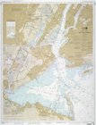
United States--east coast, Ne…
End of results
|
Top