Click to visit the main New York Public Library Homepage
The New York Public Library
Digital Collections
About Digital Collections
Browse
Search only public domain materials
Items
Collections
Divisions
Home
Search
Browse
About
Search only public domain materials
Items
Collections
Divisions
Digital Collections
Using Images
Using Data
Search
Filtered search
Show filters
Hide filters
Show Only Public Domain
topic
Real property
379
Indians of North America
2
Landowners
2
Languages
2
Nautical charts
2
More
Less
name
E. Belcher Hyde Map Company
265
E.B. Hyde & Co
265
Ullitz, Hugo
265
Hyde, E. Belcher
112
Kiepert, Richard, 1846-1915
43
More
Less
collection
Atlases of New York City
265
Atlases of the United States
146
Maps of Asia
43
Maps of New York City and State
16
Maps of North America
3
More
Less
place
x
Maps
New York (State)
382
Brooklyn (New York, N.Y.)
275
New York
267
Nassau County
112
More
Less
genre
Maps
449
Atlases
146
Indexes
12
Title pages
9
Tables
4
More
Less
publisher
E. Belcher Hyde
266
E. Belcher-Hyde
112
Berlin
41
Brooklyn Daily Eagle
2
Dietrich Reimer (Ernst Vohsen)
2
More
Less
division
Map Division
473
Schomburg Jean Blackwell Hutson Research and Reference Division
2
Wallach Division: Picture Collection
1
type
cartographic
451
text
31
still image
1
Date Range
to
476 results found
Filtering on:
x
Date
: 1870 - 1915
x
Place
: Maps
Sort by:
Title
Date created
Date digitized
Sequence
m
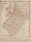
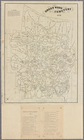
Transportation map of Brookly…
City of New York, Borough of …
m
Oyster Bay and Huntington, Hu…
Bay and harbor of New York
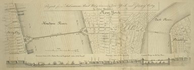
Project for a submarine rail …
Map of the Rutger's Farm as i…
m
Beers' new map of Staten Isla…
Guide map to the Parks and Pa…
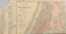
Map of New York City: showing…
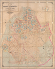
m
Borough of Brooklyn, City of …
m
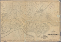
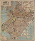
Map of the city of Brooklyn. …
Greenwood cemetery [Legend on…
Latest, most complete & relia…
Guide map of Brooklyn, Kings …
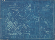
Plan of the U. S. Navy Yard, …
Map of Newtown Creek and vici…
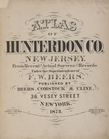
Atlas of Hunterdon County, Ne…
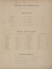
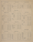
Table of Contents.
Mineral Constitution absorbed…
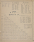
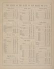
The Census of the State of Ne…
The Census of the State of Ne…
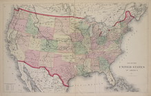
Map of the United States of A…
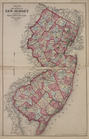
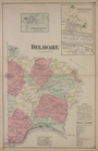
Map of the State of New Jersey
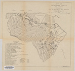
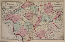
Topographical Map of Hunterdo…
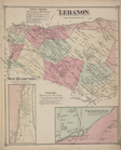
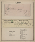
Lebanon Township Business Not…
Cokesburgh [Village]; Glen & …
Bethlehem [Township]; Bethleh…
Asbury [Village]; Bloomsbury …
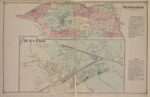
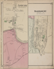
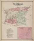
High Bridge [Township]; High …
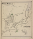
High Bridge [Village]; East H…
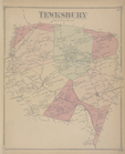
Tewksbury [Township]
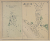
Milford [Village]; New German…
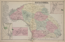
Alexandria Business Notices. …
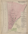
Frenchtown [Village]; Frencht…
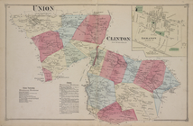
Union [Township]; Union Busin…
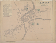
Clinton [Village]; Clinton Bu…
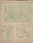
Annandale [Village]; Pittstow…
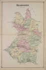
Readington [Township]
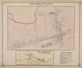
White House Station [Village]…
Station [Village]; White Hous…
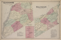
Kingwood [Township]; Kingwood…
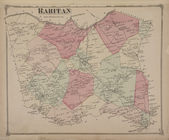
Raritan [Township]
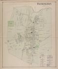
Flemington [Village]; Fleming…
Stockton [Village]; Sergeants…
West Amwell [Township]; West …
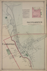
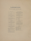
Lambertville Business Notices.
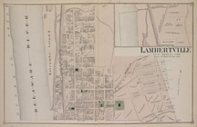
North Part of Lambertville [V…
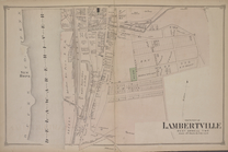
South Part of Lambertville [V…
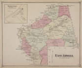
East Amwell [Township]; Werts…
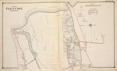
Part of Glen Cove (Harbor Por…
1
2
Previous
Next
1
2
Previous
Next