Click to visit the main New York Public Library Homepage
The New York Public Library
Digital Collections
About Digital Collections
Browse
Search only public domain materials
Items
Collections
Divisions
Home
Search
Browse
About
Search only public domain materials
Items
Collections
Divisions
Digital Collections
Using Images
Using Data
Search
Filtered search
Show filters
Hide filters
Show Only Public Domain
topic
x
City planning
Piers
5
Waterfronts
5
Streets
4
Docks
3
More
Less
name
American Photo-Lithographic Company
2
Laing, Joseph, b. 1827 or 1828
2
Serrell, James E
2
Boston (Mass.). Department of Parks
1
Davis, Thomas W. (Surveyor)
1
More
Less
collection
Maps of New York City and State
12
Maps of North America
2
place
Manhattan (New York, N.Y.)
12
New York (N.Y.)
12
New York (State)
12
Boston
2
Massachusetts
2
More
Less
genre
Maps
14
Cadastral maps
2
Manuscript maps
2
publisher
Am. Photo-Lithographic Co
1
Department of Public Parks
1
Engraved and printed by Joseph Laing
1
Health Dept. ; A.M. Photo-Lithographic Co., N.Y
1
J. Augustus Page, Esq
1
More
Less
division
Map Division
14
type
cartographic
14
Date Range
to
14 results found
Filtering on:
x
Date
: 1871 - 1876
x
Topic
: City planning
Sort by:
Title
Date created
Date digitized
Sequence
Proposed parks and parkways: …
Plan of burnt district (by fi…
Map of the city of New York m…
Grade map, Palace of Industry…
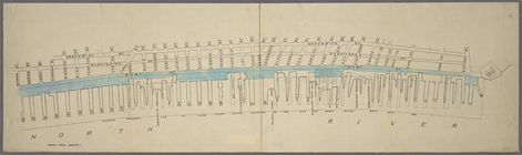
Map of West Street from Batte…
Manuscript map of the section…
Map of the city of New York m…
Copy of map or survey showing…
Paving map [Reade Street from…
m
Map of the City of New York n…
Map of New York City / drawn …
Map of the city of New York m…
m
Map of New York City south of…
m
Map showing the route for a p…
End of results
|
Top