Click to visit the main New York Public Library Homepage
The New York Public Library
Digital Collections
About Digital Collections
Browse
Search only public domain materials
Items
Collections
Divisions
Home
Search
Browse
About
Search only public domain materials
Items
Collections
Divisions
Digital Collections
Using Images
Using Data
Search
Filtered search
Show filters
Hide filters
Show Only Public Domain
topic
x
Landowners
Real property
31
Administrative and political divisions
11
Railroads
4
City planning
2
More
Less
name
Hotchkiss, Jedediah, 1828-1899
6
J.B. Beers & Co
6
Michie, Peter Smith, 1839-1901
6
United States. Army. Office of the Chief of Engineers
6
Sanford, Everts & Co
5
More
Less
collection
Maps of New York City and State
27
Maps of North America
27
place
New York (State)
27
Yonkers (N.Y.)
9
Yonkers
8
New York
6
Virginia
6
More
Less
genre
Maps
54
Cadastral maps
29
Manuscript maps
4
Facsimiles
1
Road maps
1
More
Less
publisher
J.B. Beers & Co
6
Published by authority of the Hon. the Secretary of War, Office of the Chief of Engineers, U.S. Army
6
Sanford, Everts & Co
5
publisher not identified
4
Common Council
3
More
Less
division
Map Division
54
type
cartographic
54
text
1
Date Range
to
54 results found
Filtering on:
x
Date
: 1871 - 1876
x
Topic
: Landowners
Sort by:
Title
Date created
Date digitized
Sequence
Map of Conanicut Island, oppo…
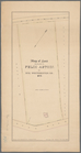
Plan of real estate at Harris…
m
Map of Pettis County, Missour…
Plan of the city of New Orlea…
Map showing lands of the Iron…
Map of the iron mines of Lake…
Portion of the copper distric…
Map of the town of Eastcheste…
Map of Shenandoah & Page coun…
Map of Rockingham County, Vir…
m
Map of the city and suburbs o…
Lincoln, the capital of Nebra…
Map of Augusta County, Virgin…
Map of Rappahannock County, V…
Map of Greene County, Virgini…
Map of Madison County, Virgin…
m
Hardee's geographical, histor…
m
Map of Fulton Co., Pennsylvan…
A plan of the town of Pittsfo…
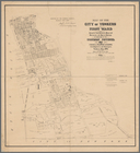
Map of the city of Yonkers, F…
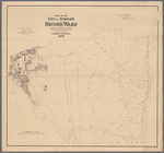
Map of the city of Yonkers, S…
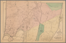
Southern part of Yonkers, and…
Map of the flats above Albany
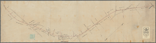
New York to New Rochelle: fro…
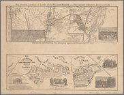
Portions of 2nd, 3rd, and 4th…
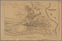
Port Jervis
Map showing location of lands…
Map of land belonging to Feli…
Portions of 1st, 2nd, and 3rd…
Limington: [Maine]
Plan of burnt district (by fi…
Hollis: [Maine]
Lebanon: [Maine]
Spring Vale
North Berwick: [Maine]
Map of the city of Taunton ma…
m
Three maps of the property kn…
Map showing location of lands…
m
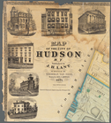
Map of the City of Hudson, N.…
Centennial map of Concord, 17…
m
Map of Tarrytown, Irvington e…
Towns of West Farms and Morri…
Ancient Windham County: names…
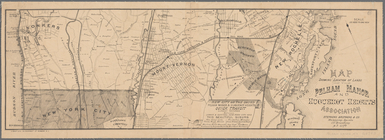
Town and City of Yonkers, Wes…
Town of Greenburgh, Westchest…
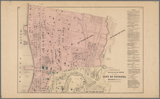
Map of the city of Yonkers, T…
Plan showing route of Rochest…
m
Map of Staten Island (Richmon…
m
Map showing the high and low …
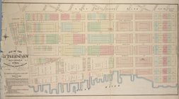
Map of the Rutger's Farm as i…